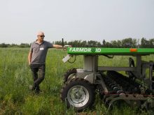
BRANDON – Imagine a digital toolbox with Google Earth maps of your field, satellite images along with high resolution aerial photos, all existing maps and field data, plus real time GPS for scouting. All rubber-sheeted and geo-referenced.
Sound expensive? Actually, much of it is free for those who know where to click. Simon Knutson, owner of GIS4AG, has developed the new package.
It is based on Google Earth features that allow it to function as a simplified GIS system. Farmers can also load their own field maps or data and layer it over the images Google Earth has of their fields.
Read Also
Herbicide resistance sprouts in Manitoba’s wild oats
Farmers across Manitoba this fall are gearing up for the latest salvo in what, for many, has become a longtime battle to beat out wild oats.
The Google Earth field images might be old and fuzzy but farmers can import quality, data-packed maps from other sources and make them work on the Google screen.
The system of co-ordinates Knutson developed enables him to rubber sheet any overlay onto a Google map so it’s correctly geo-referenced.
As farmers gain more information, they can add more layers for yield, topography, drainage, salinity, soil type, or virtually anything else they might think of as suitable for mapping,
Once the package is loaded on a tablet, plug a GPS stick into the USB port for real time location and head off the to fields.
The Google cursor guides farmers from spot to spot in the field for precise scouting and problem solving.
While Google Earth is free, an improvement on Google’s built-in GPS cursor is a $20 option, which forces the on-screen map to follow the ground location. The cursor is locked in on the tablet so there’s no need to scroll around.
The real-time position is displayed over top of the layers that have been rubber-sheeted on the base Google map.
With the high-powered field management programs available to producers today, why would anyone use technology as seemingly simple and basic as Google?
“That’s exactly why. Because it is simple and basic,” says Knutson.
“There’s a big need for a simple-to-use system capable of providing visual and data display of farm information layers. The current ag software is a barrier to farmers because none of it is simple.
“Google Earth is pretty straight forward. It has the added bonus that you can connect GPS and use it in the field as a replacement for a hand-held.”
Knutson says he has also heard numerous producers say they like the idea of being able to keep information to themselves.
“A lot of farmers don’t trust other people to make their zones and write prescription for them. They want to do it themselves. They know their fields better than anyone else, so they want to write their own prescriptions. Google Earth lets them do it themselves without going the full GIS route.”
To convert a tablet or laptop into a GPS machine, plug a GPS stick into the USB port. For ground truthing, Knutson advises taking the laptop to a few known points on the fields to check that they coincide with the cursor on the Google screen.
A farmer does not need an internet connection in the field because the Google map is not in real time. The only component that’s in real time is the cursor.
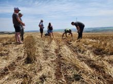
Knutson says the first step is to define the problem areas in a field.
“As you’re scouting the field with GPS plugged into your laptop and your field up on the Goggle Earth screen, the little cursor will guide you to the problem areas.
“Once you’re at the desired point, you can flip though all the various maps you have and put them up on the screen one at a time. That will give you a clue of what kind of problem you’re dealing (with) – salinity, poor drainage, gravelly soil or whatever the case may be.
“Even if you can’t find an overlay to match the problem, you can still use the Google polygon to draw a very exact zone on the map. You can walk or drive the perimeter of that spot and it will become a distinct management zone.”
Once a problem area is zoned, mark it on the Google map so you know where to return later for soil samples. Digital photos of the plants can be taken and attached to that point in the field for further reference.
The system can also help pinpoint high yield areas to help determine what’s working.
Get started
To get started, a farmer contacts Knutson with the legal description of the field he wants to Google manage. He sends Knutson maps and data relevant to that field.
Knutson’s software converts the maps into geo-referenced maps in the Google format. He e-mails the Google field map back to the farmer.
The farmer can draw zones, pinpoint soil sample spots, determine fertilizer rates for each zone, plan drainage ditches and do just about everything a full blown GIS can do, except write a controller prescription.
Knutson says his system falls short of being able to write a shape file, the necessary component to run a controller. But there is an easy way around that. The farmer e-mails his newly formed zone map to Knutson, who runs it through his GIS machine and turns it into a Google-friendly shape file, which he e-mails back to the farmer.
The farmer now has control of his shape file. He can write prescriptions and alter them on his own computer, without requiring GIS. The shape file is capable of running controllers for seed, fertilizer, spray applications and drainage.
The farmer draws his zones either on-screen in Google or by hand on a printout of the screen image and sends it to Knutson to convert to a shape file.
The farmer can then create the controller file himself from the shape file or have Knutson generate the controller file.
A new controller file can be generated for different applications by assigning the required rates to the zones previously created by the farmer.
If those zones remain unchanged for 10 years, the farmer can use the same shape files for 10 years.
However, if the field changes with improved management, the farmer can go back to the basic Google system and re-draw his zones. The new zone map is sent to Knutson who again converts it into a shape file.
“If you were to buy a commercial GIS system to do this same work, you’d spend $3,000 and you’d have a very complex system to learn about.”
When Knutson converts an existing field map or aerial image into a geo-referenced format for Google or any other format, his basic fee is $25 per image.
Creating and converting a yield map to display in Google runs $75 to $100 per field. Converting new or archive Landsat images to NDVI maps (normalized difference vegetation index) and exporting into Google or other formats costs 50 cents per acre.
Higher-resolution aerial and satellite imagery can also be obtained and provided in Google format for field scouting using fresh images.
Knutson’s core business is producing topography maps for drainage issues. In those transactions, there is no extra charge to have a map put into Google or other format.
For more information, contact Simon Knutson at simon@gis4ag.com or visit www.gis4ag.com. Download the latest version of Google Earth at earth.google.com/index.html.