Your farmyard weather station is good at predicting weather you’ve already experienced. It predicts history. And your rain gauge is only accurate within a radius of about eight inches.
These encouraging words come from Daryl Ritchison, chief meteorologist at the North Dakota Agricultural Weather Network called NDAWN. He says your weather station and rain gauge have nothing to do with making weather predictions or helping you make better management decisions.
Ritchison explains, “There are different types of meteorology relating to agriculture. Synoptic meteorology is the general weather map we see on television. It predicts atmospheric changes at scales up to 1,000 kilometres and for long periods of time, such as 28 days.
Read Also
Pen riders better than tech at detecting respiratory disease in feedlot cattle, says researcher
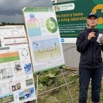
Katrina Garneau’s recent research found that pen riders are better than technology at flagging signs of BRD in feedlot cattle.
“The Agricultural Weather Network I’m in charge of uses Mesoscale meteorology which has a horizontal range from one km to 1,000 km and a vertical range starting at the Earth’s surface and extending to the atmospheric boundary layer. Mesonet meteorology predicting periods last from less than one day up to a week. The events typically include thunderstorms, squall lines, fronts, precipitation bands and topographically generated weather systems, such as mountain waves and sea and land breezes.”
He says the term mesonet is derived from meso and network. In meteorology, a mesonet is typically a network of collectively owned and operated automated weather stations that are installed close enough to each other to observe, measure and track meteorological phenomena. The stations are linked to produce a big picture of little areas. The new mesonet in New York is the epitome of high-end mesonets. It has a station in every 15 miles radius, totalling thousands of individual stations linked together.
In meteorology, the term mesonet refers to the network, not the scale. The scale they often deal with is micro meteorology. Ritchison says predicting a major thunderstorm falls into this small scale micro meteorology. These forecasts focus in on one km or less. Individual thunderstorms, clouds, and local turbulence caused by buildings and other obstacles, such as individual hills are modelled on this small scale. People in those small, intense cores may get five inches of rain, while folks across the road get nothing. Ritchison says we’ve all experienced that phenomenon.
“I always remind people that weather forecasts are not perfect. Don’t expect perfection. But is the forecast useful? Most farmers agree it is useful.
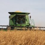
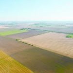
“When we have farms that are 2,000 acres and much larger, you have to realize that the whole farm will never get equal amounts of precipitation. There is no forecast that can be accurate for the whole 2,000 acres. But a mesonet, such as NDAWN can give you better forecasts, no doubt.”
Ritchison says the goal of his NDAWN mesonet is to have a station in every 20 mile radius. Most weather parameters are accurate within a 15 to 20 mile circle. So far, NDAWN has 113 stations.
He says rainfall data is difficult to deal with. It’s only accurate within a six or eight inch circle around the rain gauge. If your radio or weather service tells you Brandon got two inches of rain, that only means that the little area surrounding their gauge got two inches, says Ritchison.
“I’ve had a couple conversations with the North Dakota governor. He’d like us to build a better precipitation network, basically expand our NDAWN to cover the whole state. If we put a station on every square mile, there’s 68,000 sq. miles, you’d need 68,000 stations and you’re still going to miss stuff because these weather cells are smaller than a kilometre or sixth-tenths of a mile. The hail cores are even harder to deal with, because sometimes they’re only a hundred yards wide.
“And you’d have to buy the good gauges, the $30 ones. The little cheap ones the insurance companies give you aren’t any good. A farmer friend of mine did that. He bought enough of those $30 gauges to cover his whole farm really well. And he told me they really gave him good information. The trouble is somebody came along one night and stole them all.”
Radar working in conjunction with weather networks like NDAWN can do a good job of tracking rain clouds. But predicting rainfall is difficult. Raindrops range in size from 0.1 to 9 millimetres in diameter.
As a raindrop increases in size, air resistance causes its shape to become more oblate, with its largest cross-section facing the oncoming airflow, thus causing it to split into two smaller raindrops. These smaller spherical drops are called cloud droplets, which usually evaporate before reaching Earth. Droplets are safe as long as they remain in the cool moist environment of the cloud, but vaporize once in warm air. This makes precipitation prediction difficult.
“And by the way, contrary to popular belief, raindrops are never shaped like raindrops. They come in all shapes, but never raindrop shapes.”