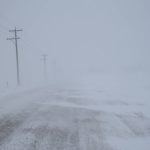
It’s easy to look out the window and conclude that four inches of snow fell overnight, but accurately measuring snow depth is challenging, says Alf Warkentin, director of flood forecasting for Manitoba Water Stewardship.
“It’s never as accurate as we’d like it to be. The snow is very difficult to measure.… You can do a snow survey sample on one field and get 75 mm. Then you drive a mile to another field and you get half of that,” said Warkentin, who noted snow gauges are not much better.
Read Also
India slaps 30 per cent import duty on yellow peas
India has imposed a 30 per cent duty on yellow pea imports with a bill of lading date on or after Nov. 1, 2025.
“A lot of our heavy snow comes with strong winds, and then the gauges don’t catch properly. A lot of the snow blows over top of the gauge.”
It’s also tricky to determine the amount of water in the soil and how much water is flowing in streams. But technology is evolving to help water experts, like Warkentin, edge closer to an accurate picture of the amount of water in the snow, the soil and streams of Western Canada.
As Warkentin noted, the amount of snow on the ground can vary greatly within a short distance. Accurately measuring soil moisture is also a headache because one part of the field may be extremely wet but a location at slightly higher elevation may be significantly drier.
Consequently, scientists need to gather an immense amount of data and calculate the average from hundreds of readings.
Instead of having a technician trudge through snow-covered fields with sample bags and a measuring stick, Warkentin and his colleagues collect most of their data from the air.
While flying over a strip of land approximately 13 kilometres long, a sensor inside the plane detects the amount of gamma (short wavelength) radiation emitted from the earth.
“The soil emits gamma radiation because there’s radioactive elements in the soil and if you have an accurate detector, you can find out … the strength of that radiation signal.”
If there’s a high percentage of water in the soil and when snow is deeper, it blocks gamma rays and reduces the signal detected in the plane.
After comparing the amount of radiation to a baseline signal, it’s possible to estimate how much snow is on the ground and the amount of water in the soil.
To achieve a more accurate estimate, scientists combine the data from the plane with snow measurements done the old-fashioned way, on the ground.
“We actually go out and weigh (snow samples) and figure out the water content,” Warkentin said.
In the mountains of Alberta, technicians also take samples of snow, but don’t rely on airplanes and gamma rays for the bulk of the data.
Instead, automated gauges in strategic locations collect snowpack information in the Rockies, said Scott Vatcher, a river flow forecaster with Alberta Environment.
“They’re called snow pillows…. By the weight of the snow on this pillow, they can figure out the water content of the snow,” he said.
A snow pillow is a three metre diameter bladder filled with antifreeze solution, according to Alberta Environment’s website. As snow accumulates on the pillow, it pushes antifreeze out of the bladder and into a standpipe. The height of the fluid in the standpipe measures the weight of water on the pillow.
Similar to measuring snow, the methods used to estimate stream flow are becoming more technical.
However, many readings are still collected by an employee standing in a stream, said Dan Selinger, hydrological services supervisor at Water Survey of Canada, a department of Environment Canada that gathers data on water quantity.
A technician will stand in a stream with a current meter, a device with small cups that spin around as the water flows by. The employee then counts the number of times the cups revolve.
“If you get 10 revolutions in 40 seconds … there’s a chart corresponding to that,” said Selinger, who is based in Regina.
When the river or stream is too deep for wading, the technician will lower a current meter from a bridge.
“We’ll lower a big lead weight, it looks like a little bomb, down into the water,” Selinger said. The meter is attached to the lead weight.
Gathering water flow data this way takes time because technicians have to take 20 to 25 readings at one cross section of a stream. They also measure the water depth for each reading to calculate the area of the cross section.
“(We) follow the simple equation that discharge equals velocity times area,” said Selinger. But this time consuming method of calculating stream flow is coming to an end.
“We’ve made quite a shift towards the newer technology.”
The new technology is a device called an acoustic velocity flow meter, which works on the Doppler principle.
“An acoustic signal, a sound wave, is sent out from the sensor and based on what happens to that signal in the water it calculates the water velocity,” Selinger said. “The sensor also obtains a water level and calculates a cross sectional area. It then applies the velocity to the cross sectional area producing a discharge rate in continuous real time.… The data we get out of it is a lot better.”
That accuracy comes at a cost. Each acoustic velocity flow meter has a price tag of $50,000 or more.
But collecting water data is worth it, Warkentin said. Without detailed information, accurate forecasts are impossible.
“To get good data is not easy. It’s one of the main impediments to water management.”


