Information on Saskatchewan soils collected throughout the 20th century by the provincial soil survey is readily available through a new online platform.
The Saskatchewan Soil Information System (SKSIS) was launched during the University of Saskatchewan’s Soils and Crops meeting in Saskatoon by Angela Bedard-Haughn, head of the department of soil science at the U of S.
“Our goal was to make it easier for people to use the existing soil survey information in an online format.”
She said the new system makes it easy for people to explore the information and use it to better understand the different soil types in different areas.
Bedard-Haughn said users will then be able to look deeper into how they can use the information help with management decisions.
The SKSIS started in 2016 as an initiative to enhance the accessibility of the provincial soil survey information, with funding from provincial ministry of agriculture, Saskatchewan Canola and the Saskatchewan Pulse Growers.
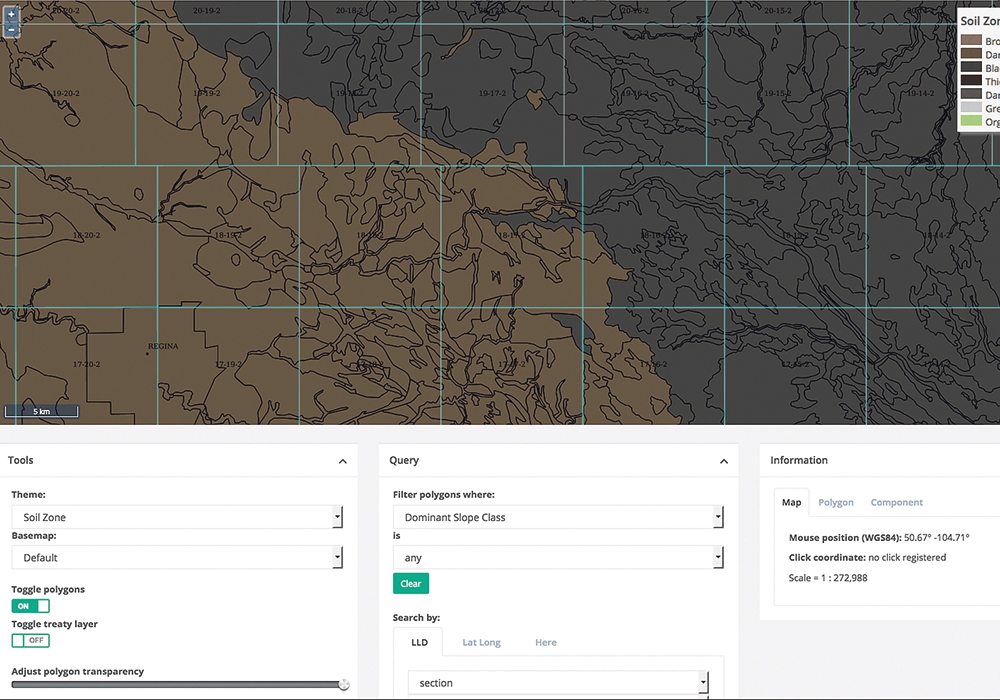
SKSIS uses base map information from the soil surveys and overlays aerial satellite images. Users can choose display themes, the transparency of the satellite imagery and the type to display.
Users have many options on how to filter soil survey information to get a better sense of what’s happening on the landscape, including surface expression, slope descriptions, stoniness, texture, agriculture capability and salinity.
Read Also
Invigor Gold variety viewed as threat to condiment mustard
Invigor Gold, the canola-quality mustard developed by BASF, is on a collision course with Canada’s condiment mustard industry. It’s difficult to see how the two can co-exist.
Users can search for specific locations by using township and range denotations, or by using latitude and longitude.
Registered users can upload new information to the site, including photos, or geolocate studies performed in a specific area.
Semi-automated protocols are also being developed to help users upload information they’ve collected on their fields.
SKSIS also aims to refine existing soil data with the use of digital soil mapping techniques. Further data enhancements, including data gathered using LiDAR (light detecting and ranging), is expected to be added to the site in the future.
For more information, visit sksis.usask.ca/#/map

