Farmers in a small area of Saskatchewan and most of Manitoba should prepare for another soggy start to seeding, say forecasters.
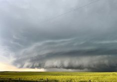
“What I see is major flood risk across southern parts of Manitoba and extreme southeast Saskatchewan during April and early May,” said Brett Anderson, Canadian weather expert with AccuWeather.
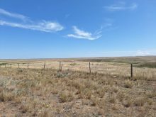
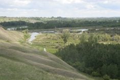
Above-normal winter snowfall, unusually high river levels and the potential for ice jams will lead to a major flood risk in low-lying areas near rivers and streams.
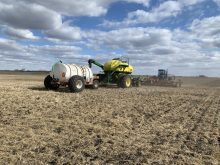
That could lead to delays in fieldwork and seeding in those regions.
Read Also

Farming Smarter receives financial boost from Alberta government for potato research
Farming Smarter near Lethbridge got a boost to its research equipment, thanks to the Alberta government’s increase in funding for research associations.
“It’s just going to be a slow start if this happens like we think it’s going to happen,” said Anderson.
His forecast coincides with government reports out of Saskatchewan and Manitoba.
The Manitoba Hydrologic Forecasting and Coordination Branch of Manitoba Infrastructure issued its first spring 2017 flood outlook on Feb. 27.
“The recent warm weather helped to reduce the flood risk slightly but did not eliminate the possibility of moderate to major flooding in areas of the province this spring,” said the department in an email issued in advance of the outlook.
Inflows from the northern United States in the Red River Basin and the Souris River Basin are a concern, as is the Lower Assiniboine River in western Manitoba.
Future precipitation and the rate of melt will be key factors in determining the flood risk. The second outlook scheduled for the end of March will have a more accurate forecast.
“But at this time we are expecting moderate to major flooding in south, southwest, southeast and central Manitoba including the Red River, the Souris River, the Pembina River and the Lower Assiniboine River,” said the department.
Saskatchewan’s Spring Snowmelt Forecast is scheduled for early March.
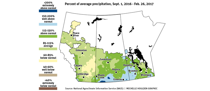
The Preliminary Runoff Outlook report produced by the Saskatchewan Water Security Agency in February calls for below average snowmelt runoff for most of the province due to well below average snowpack.
The exception is the southeastern corner of the province where it was wetter than average at freeze-up and then received average snowfall.
It is a blessing that snowfall across most of Saskatchewan has been much lower than normal this winter because soil moisture was excessive heading into winter.
“The month of October brought record or near record precipitation to most of the province, including many areas that had already experienced a wetter than normal summer,” stated the report.
“Many areas of the province were as wet or wetter than they were going into freeze-up in 2010.”
That was the year Saskatchewan was deluged by summer storms. Environment Canada said the province was never wetter.
There has been a spell of warm weather since the report was prepared, which has reduced the snow pack across much of the province. There is already some runoff happening in the southwest.
But it did not change the situation in the southeastern corner, where there remains ample snow cover.
“We’re still expecting an above normal runoff in the lower Souris Basin below the Rafferty and Alameda dams,” said Patrick Boyle, spokesperson for the Saskatchewan Water Security Agency.
Anderson had more bad news for Manitoba farmers. A storm track from the central U.S. Plains is expected to move into southern Manitoba this spring.
“We are calling for above normal precipitation, which includes rain and snow across southern parts of Manitoba, which again will further add to the risk of flooding across that region,” he said.
There are no real strong precipitation signals for the rest of the Prairies. Temperatures in the western half of the region in March and April are expected to be slightly below normal while the eastern half will be closer to normal. That bodes well for a gradual thaw, which will help reduce flood potential.
“Once we get into May, I think we could see a significant turnaround as temperatures actually may trend above normal across much of the region,” said Anderson.