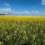
I’ve been feeling a little odd, a bit out-of-sorts for the past couple of weeks, and I have figured out why: I am not covering massive flooding of Manitoba farmland.
So often in mid-April to mid-May in recent years I’ve been heading off to cover the stories of millions of acres of farmland being inundated by floodwaters spilling out of the Red, Assiniboine and other Manitoba rivers, as farmers race to protect home and farm. But this year I’ve been doing none of that, because at least in 99 percent of areas, there is no major flooding. (There are big problems south of the Shellmouth dam in western Manitoba near the Saskatchewan border, but that’s more of a chronic, localized problem.)
Read Also
Trump’s trade policies take their toll on Canadian producers
U.S. trade policy as dictated by president Donald Trump is hurting Canadian farmers in a multitude of ways.
So I decided to go out to flood country anyway, just to see what these places I’ve visited in recent years, especially with the epic 2011 Assiniboine River flood, look like in a semi-normal spring.
I shot this video when I headed out to the Assiniboine Diversion north of Portage La Prairie, to the Hoop and Holler area southeast of Portage, and to the land between Marquette and St. Francis Xavier. I apologize for the screeching, howling sound of wind that is in some of the video, but the wind was intense and cold, and even started blowing big chunks of snow at me, so consider it part of the Prairie spring ambiance.


