BRANDON – You can stand on the top of a step ladder, on the back of a truck parked on the highest knoll in the field, but you still won’t get that bird’s-eye view needed to identify problem areas in your crop.
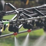
You can try to get that bird’s-eye view from a satellite – if it’s not cloudy and if the satellite happens to be flying over your farm the day you need the information. Some farmers have waited for more than six years for a satellite image of a specific field. If you’re spending money on a spray application today, old photos are of little help.
Read Also

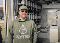
VIDEO: Green Lightning and Nytro Ag win sustainability innovation award
Nytro Ag Corp and Green Lightning recieved an innovation award at Ag in Motion 2025 for the Green Lightning Nitrogen Machine, which converts atmospheric nitrogen into a plant-usable form.
For those lucky enough to get a timely satellite image, it may not have the resolution necessary to scout out insect, disease, drainage, salinity or fertility problems.
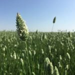
Another option is to walk fields or drive a grid pattern with an all-terrain vehicle. That can provide a close-up look, but you can still miss problem areas and you may not be able to accurately judge the crop’s density. For those who farm a lot of acres, personal scouting is out of the question.
Yet something started on a lark by a handful of farmers back in the 1920s remains one of the best methods for checking crop health: the airplane.
In those days, it wasn’t considered precision agriculture. It was simply good fun to fly around comparing other farmers’ fields. Today it remains effective, but it has become costly.
That’s where the remote control CropCam airplane enters the scene. A CropCam can be fully global positioning system referenced, so it will fly a precise grid pattern over a field.
It carries cameras that record high-resolution, GPS referenced colour and infrared photos. The latest photo technology yields up the same kind of Normalized Difference Vegetation Index images produced by satellites, but on a timely basis and with greater clarity.
You can shoot the field in the morning and have a prescription map for spraying that afternoon, according to AgriTrend coach Dennis Vermette, owner of a fully outfitted CropCam.
“I personally felt there were too many limitations with satellite photos,” says Vermette, explaining why he invested in the CropCam equipment in 2008.
“CropCam gives my clients better resolution than most satellite images, better value for their dollar compared to satellites.
“In the worst situation, I shoot at sub-meter resolution. In some situations I shoot at sub-foot resolution. And clouds don’t stop me from taking photos. About the only things that stop me are pouring rain, fog at ground level or winds over 30 kilometres (per hour).”
Vermette says the NDVI is the same type of image produced by satellites, only more precise. Dense crop reflects better than a thin crop. Once he identifies the weak areas in a field, it’s time to ground truth the image.
CropCam images are all geo-referenced, so Vermette can go to the exact spot in the field that registers low productivity. Soil samples, plant tissue samples and visual observation all help determine the problem and how it might be resolved.
“Once I’ve ground-truthed the images, I make zone maps for each kind of problem. If a zone is fixable, I work with the producer to figure out how we solve the problem.
“If a zone can’t be fixed, such as a severe salinity problem, we make a prescription map so they don’t waste any more input dollars on those areas.”
For example, a producer can take 60 non-productive acres out of a half section field and reduce the input costs to only seed and weed control. The overall yield of the field remains the same, but the inputs have been slashed.
Is it really possible to fly a field in the morning and have a prescription map ready the same afternoon?
“Absolutely,” says Vermette, explaining that he carries all the necessary technology in his truck.
“First I fly the field and shoot the images. I stitch them together on my laptop and convert them to NDVI images. Then I go out and ground truth the map so I know for sure what I’m seeing.
“Once we’ve determined the problem, I make the prescription map. We overlay the fresh CropCam images with whatever relevant images the client already has such as yield maps, drainage maps or topography maps.
“If we’re dealing with an immediate disease issue, I can produce a fungicide prescription map that same day.”
Vermette says the normal turn-around time for a prescription map is 24 hours, but instant response is do-able if needed. Because the CropCam autopilot is locked into GPS and a pre-determined grid pattern, Vermette says the images are compatible with other GPS referenced maps.
Noting that plant disease and fungicide application are often related to topography and drainage, Vermette says the best approach is to work on long-term solutions.
“The drainage factor is so badly overlooked in most areas. With a good set of aerial photos, you can see problems you never knew about.
Vermette says timely, high resolution CropCam images are also valuable in determining winterkill in forage and fall-seeded crops, as well as obtaining accurate crop insurance information.
For more information, contact Dennis Vermette at dvermette@agritrend.com.