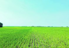
Farmers can skip their flying lessons if they buy a CropCam remote control airplane for their future crop scouting and aerial photo ventures.
The company from Stony Mountain, Man., has removed the risk of pilot error from its new crop surveillance aircraft by removing the pilot.
With 10 years experience engineering autopilot components for aeronautical clients, the folks at CropCam decided to expand into agriculture. They reasoned that the most accurate and useful agricultural aerial photos could be taken only from an aircraft flying a precise grid pattern over the field at a precise altitude.
Read Also

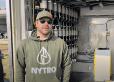
VIDEO: Green Lightning and Nytro Ag win sustainability innovation award
Nytro Ag Corp and Green Lightning recieved an innovation award at Ag in Motion 2025 for the Green Lightning Nitrogen Machine, which converts atmospheric nitrogen into a plant-usable form.
To be useful, the grid had to be repeatable without the slightest variation. They knew the only way to accomplish this was GPS and autopilot. People are twitchy.
“Flying a radio controlled airplane and accurately keeping it on any sort of grid pattern while maintaining an exact altitude is a big challenge for even the best of remote control pilots at the best of times,” said CropCam project director Lisa Shaw.
With that in mind, CropCam’s engineers started work on a new fly-by-wire agricultural aerial photo surveillance plane.
The operator on the ground does not fly this airplane. All navigation and flight control is managed through an on-board Trimble GPS connected directly to the flight controller.
“Once your GPS initializes, the airplane automatically climbs to a preset altitude and flies the precise pattern you have already programmed into our CropCam software,” Shaw said.
“It takes photos at predetermined points along the route and geo-references each picture. It never gets lost because GPS gives it the exact location.”
The operator hand launches the CropCam at one corner of the programmed field. The plane follows the flight plan that the operator has already programmed into the laptop computer. After the plane has taken the prescribed photos over the locations, it flies itself back to the home corner and gives itself a gentle, low-speed landing. The operator then downloads the photos to the laptop.
“You can come back the next day or in 10 years and take follow-up photos of those exact same spots at the exact same 2,100 feet altitude above your field,” she said.
“If you want your aerial photos to be management tools with long-term economic value, you need the capability to repeat the exact location over and over.”
The plane’s autopilot also makes it easier to keep the airframe stable for photos while flying in wind, which can be a challenge for human operators.
“It’s pretty difficult for your thumb to fly a radio controlled airplane in gusty winds,” she said.
“If you live on the Prairies, you live with wind. We’ve flown the CropCam in gusts of 20 to 30 km-h and still produced acceptable images. Just out of curiosity, we’ve also flown it in constant winds 60 to 70 km-h, but of course those images weren’t so good. The calmer the day, the better the images.”
In 2005, CropCam ran more than 250 test flights on farms in Manitoba. Those test flights were run at an altitude of 400 feet.
Shaw said farmers’ general reaction was that they wanted the camera at a higher altitude. CropCam has since received permission from Transport Canada to fly its planes at 2,200 feet. Shaw said the company will limit the altitude to 2,100 feet so that it can be certain to stay within the restriction.
At 2,100 feet, Shaw said CropCam obtains good, clear images of a whole quarter section with just four photos. While four photos are good enough for visual interpretation, they do not provide enough overlap for GIS or geo-referencing.
The higher degree of accuracy and overlap requires 10 to 12 images for each quarter section.
CropCam has been using a five megapixel Pentax Optio s5i camera that downloads to special software it has created for agricultural purposes.
“Our software automatically pieces the photos together, geo-references everything and of course rotates the finished photo so north is at the top of your screen. It also places the exact longitude and latitude on each individual photo.”
Farmers can then import the images to whatever software they are using and use the images to layer over other field data, make prescription maps, design drainage and locate cattle in rough terrain.
Satellites obsolete?
Shaw said timing is one of the big advantages that a remote control aerial photo plane has over satellite imagery.
A big problem with satellites is the seven to 14 day waiting period before they are in the right position lined up over a producer’s farm.
“If you’re doing something like crop diagnostic work or drainage planning, that’s too long.”
Cloud cover is another limitation with satellite photos, as is their 30 metre resolution.
“A CropCam photo has a very clear three centimetre resolution. It’s much more useful and much more immediate.”
The company sells its planes with either hi-tech electric motors or gas engines, depending on a client’s preference. The gas powered planes use the same glow fuel that hobbyists use in model airplanes.
Shaw also said CropCam has solved the vibration problem.
“For one thing, the camera is on the sport setting, so it’s fast. Another feature of that camera is that it also has enough capacity for 35 minutes of video if that’s what you want.”
The CropCam airframe is made of fiberglass and composite material. It is a little more than a metre long with a 2.5 metre wingspan and weighs 2.5 kilograms when loaded and ready for takeoff.
The propeller is spring-loaded and folds back to avoid breaking in a rough landing.
The CropCam lists for $12,900, which includes all necessary hardware, software and training, but not the camera.