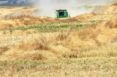
Plenty of water is covering farmland in Alberta, Saskatchewan and Manitoba.
But how much water, and on what amount of farmland?
Iunctus Geomatics Corp. of Lethbridge is the latest player among several prairie companies that can give precise answers to those questions, which might come in handy this year for crop insurance programs or potential payments for unseeded acres.
Iunctus collects satellite images and can identify and calculate water coverage on specific land locations. Farmers can buy satellite images for use in crop insurance and other claims.
Read Also

Manitoba searches for Plan B on canola oil exports
A new report explores Manitoba’s current canola oil trade and possible alternative markets to the U.S.
The service is similar to those offered by Saskatchewan and Manitoba companies, but it may be the first in Alberta.
Matt Wirzba, image processing technician with Iunctus, said it’s a relatively new use of the company’s satellite data, which is more typically used by the oil and gas, forestry and mining industries.
“We didn’t really plan to do this service,” said Wirzba.
“A few farmers came to us last year and said, ‘we hear you sell satellite imagery. What can we do with that imagery to help us with this flooding problem?’ So we sat down with them and developed this method where we take our imagery, they show us where their farms are and then we use those sections and quarter sections of their farmland and print out maps.”
Wirzba said software calculates how much area is under water, measured by either square kilometre or acreage.
Customers receive a printout for each quarter section, indicating location of water and the size of area that is covered.
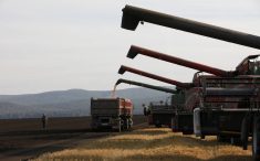
Eliason Farms of Wrentham, Alta., used the Iunctus service last year to calculate acres for the government’s unseeded acres payments.
“It made our life a lot easier,” said Sabrina Shular of Eliason Farms, which farms 3,000 acres.
“We got a better idea of our flood claim.”
Shular said the satellite data was available within two days of request and saved an estimated eight to 10 hours of field scouting.
The farm subscribes to a Google Earth package, but she said its data is accurate only within six months. By contrast, Iunctus had days-old information.
Wirzba said the satellite images have a 2.5 metre resolution.
“Essentially every pixel on the image is 2.5 metres in size. With that detail, you can see your farmstead and your Quonset and your barn. You can start to make out your cars, but where the detail gets lost is, you can’t tell what kind of car it is.”
Wirzba said he has received several calls for the ser vice this year, although he expects the peak will come when the seeding window closes and farmers need exact measurements on unseeded acres.
The Alberta and Saskatchewan governments, in conjunction with the federal Agri-Recovery program, offered $30 per acre for land unseeded because of excess moisture last year.
No program has been announced for 2011, but it’s possible one may be developed given wet conditions across much of the Prairies.
Iunctus, derived from a Latin word for sharing, is the exclusive distributor in Canada of satellite data that is collected from the Spot satellite system. It has a satellite receiving station on the University of Lethbridge campus.
“We basically have control over a satellite when it’s in Canada, so we have been programming our satellite to collect imagery over southern Alberta, Saskatchewan and Manitoba,” Wirzba said.
Farmers can request satellite images of any specific quarter section, he said. Delivery is usually possible within a few days, depending on demand and weather conditions. Satellites cannot provide images through cloud, and snow cover is also a hindrance.
Price is determined by the number of quarter sections involved, starting at $50 per quarter. However, the minimum order size is 10 quarters, so it will cost at least $500. Price is reduced as the requested area size increases.
“It’s pretty cost effective and it’s nice, I think, for farmers to have some satellite imagery of what their farm looks like,” Wirzba said.
“Then they can use that to help manage things, with digging trenches and stuff to help water runoff.”