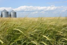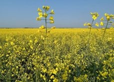
More rain is in the forecast for summer but not the multi-day soakers that disrupted spring seeding, say weather forecasters.Environment Canada, the Weather Network and World Weather Inc. are all calling for above normal precipitation throughout much of the Prairies during June, July and August.“We’re probably going to still see a fairly regular occurrence of weather disturbances producing additional periods of rainfall,” said Drew Lerner, president of World Weather Inc.“We won’t go into any prolonged dry period.”But it’s not going to be the persistent rains that drove farmers nuts, keeping them off their fields in May and early June.“It’s going to get better just because it’s going to get warmer and we’re going to see better drying between events,” said Lerner.Chris Scott, forecast operations manager at The Weather Network, predicts it will be wetter than normal in eastern Saskatchewan and southern and central Manitoba. Alberta, western Saskatchewan and northern Manitoba should be near normal.“This pattern may try to persist into at least early July that we are a little bit wetter than average,” he said.He agreed that the rain will arrive in scattered showers and thunderstorms rather than moisture-laden systems farmers witnessed this spring.Environment Canada also forecasts above normal precipitation for most of Saskatchewan, northern Alberta and southern Manitoba. The agency also calls for above normal temperatures during summer.Lerner doesn’t agree with the temperature forecast. His models show it will be warmer than it has been but near normal for summer.Either forecast will be a reprieve from this spring’s cool and wet conditions. Scott said much of the prairie grain belt was hit with two to three times the normal rainfall in May. Southern Manitoba received an average of 150 milli-metres of rain compared to the long-term average of 50 mm.“That’s a big difference,” he said.He blamed the deluge on a persistent area of low pressure in the northern United States that kept pushing storms north of the border.“It’s a bit unusual that it has lasted for this long,” said Scott.Lerner said an active jet stream allowed storm systems to move across North America. A high pressure ridge over the U.S. Midwest kept the storms from moving east, pushing them north of the border instead.The problem was exacerbated by a temperature anomaly that saw cooler than normal weather in the higher latitudes and warmer than normal in the lower latitudes.That dichotomy helped create the strong jet stream and when a cool front moved through, it boosted the amount of rain in the system.“All of this put together is what created all the wet weather,” he said.But farmers are more interested in what lies ahead than what happened in the past, said Lerner. With the late seeding, many are wondering about the potential for an early frost.“From what I’ve seen so far, I don’t see very high potential for earlier than normal freezes. I think they will be on time or just a little bit later than usual but not as late as last year.”
Read Also
StatCan stands by its model-based crop forecast
Statistics Canada’s model-based production estimates are under scrutiny, but agency says it is confident in the results.