The moisture situation has improved in the western Prairies in the last couple of weeks.
This has relieved stress on crops and pastures, but yield potential has already been severely limited in some areas of Saskatchewan and Alberta.
This first map is from Statistics Canada’s Crop Condition Assessment Program. It shows normalized difference vegetation index for July 6-12 compared to normal. Yellow shows areas where the NDVI is similar to normal. Pink areas are lower than normal and brown areas are much lower.

Read Also

Gene editing digs deeper space in Canadian plant breeding
More Canadian research into crop variety development is incorporating gene editing, and one researcher notes that Canada’s regulatory approach to gene editing will help drive innovation
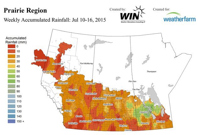
The following map from Weatherfarm shows accumulated rainfall for July 10-16
—————–
The amounts in the previous map did not look impressive, but in many areas, the week produced accumulations that were 150 to 200 percent more than normal for that week. This map is from Agriculture Canada.

——————–

—————————————
Looking ahead, the following map from the U.S. National Oceanic and Atmospheric Administration map shows expected accumulations for Saturday July 18

—————————————-
The following is the forecast for Sunday July 19
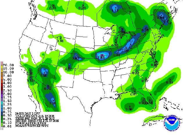
The following is the outlook for Monday July 20
——————————————-
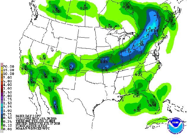
This last map from NOAA shows what was the expected accumulation for Friday July 17 to Wednesday July 22. The heavy accumulation expected in eastern Alberta was mostly to arrive on Friday. Judging by the Environment Canada radar on Friday, the largest accumulation might have been a bit farther east in west central Saskatchewan.