Forecasts of an El Nino-influenced summer might be premature, according to a U.S. government agency that studies the oceans and atmosphere.
Bryce Anderson, senior meteorologist with DTN, has been telling people there is a 60 percent chance of El Nino replacing La Nina by June.
He based his forecast on the fact that an El Nino system has immediately followed a La Nina system in six out of the last 10 times there has been two consecutive years of La Nina weather.
Mike Halpert, deputy director for the U.S. National Oceanic and Atmospheric Administration, said coming to that conclusion is a big leap of faith because of the lack of data.
Read Also

Internet of Things tapped for better emissions insights
Interconnected field sensor fleet allows better soil monitoring coverage and, hopefully, live insights on farm greenhouse gas emissions and nitrogen fertilizer application for farms.
“If you think about the history of the world, that’s a fairly small sample size,” he said.
The NOAA has issued a forecast calling for a 15 percent chance of El Nino in May-July compared to a 75 percent chance of neutral conditions and a 10 percent chance of La Nina.
Neutral is by far the most likely scenario in spring and summer. It isn’t until November-January that the probability of El Nino rises to 40 percent, marginally eclipsing the odds for neutral conditions.
“Since that forecast came out, we’ve had more model runs and they are kind of leaning more towards El Nino,” said Halpert.
He doesn’t know whether the probability of a winter El Nino will rise to 50 percent by the time the agency’s next monthly climate forecast is released May 3.
However, he said it is highly unlikely that it will reach 60 percent for the summer, as DTN is forecasting.
“If history is the judge, we wouldn’t really expect to see El Nino until the fall or early winter.”
Halpert said any climate forecast made during this time of year is suspect because there are too many random variables that can hinder the outlook.
“We’re kind of in the middle of what is affectionately called the spring barrier,” he said.
“We know that what we’re looking at historically has not proven to be the most skillful forecast.”
Even if an El Nino event developed as early as this summer, it is unlikely that it will be strong enough to drastically influence weather patterns, certainly not one of the magnitude of the 1997-98 or 1982-83 events.
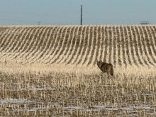
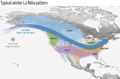
El Nino events tend to have more of an impact on winter weather than summer weather in North America. It can bring cool and wet weather across the southern United States and milder and drier winters in Canada.
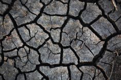
A winter El Nino could affect the palm growing countries of Indonesia and Malaysia. It would create dry conditions in that region of the world.
Michael Shean, an international crop analyst with the U.S. Department of Agriculture’s Foreign Agricultural Service, said most El Nino events have a limited effect on palm oil production.
“It would have to be a pretty severe event for it to significantly influence palm yields.”
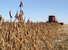
The last time that occurred was the 1997 El Nino, which contributed to a 12 percent decrease in Malaysia’s palm yields the following year and a 19 percent drop in Indonesia’s.
“If we’re just phasing into an El Nino, it’s less likely you’re going to see that kind of an impact,” said Shean.
Any yield decline wouldn’t be felt right away because there is usually a one-year lag between drought and reduced yields for palm trees.