A storm that covered much of southern Alberta with rain and heavy, wet snow April 1-2 has increased concerns about flooded farmland and municipal roads.
Tom Thacker, reeve of the County of 40 Mile, said April 4 that more than 200 municipal roads are submerged in places, and the situation is similar in the neighbouring County of Cypress and Municipal District of Taber.
The storm brought 11 millimetres of rain and 15 centimetres of snow to much of the region. The area had previously received about 250 percent of normal snowfall.
Read Also

VIDEO: Case IH reveals new Optum tractor at Agritechnica 2025
Case IH reveals its new Optum tractor at Agritechnica 2025.
“We expect more roads to be flooded out and some rural residences could be threatened by water,” said Thacker.
“It’s really hard to tell where all this water will end up.”
Farmland is saturated, having entered the winter wetter than usual from fall rain.
“There’s thousands of acres that are presently duck material,” Thacker said.
“I would suspect there will be quite a bit of land that will be not seeded.
“We had some last year that was not seeded due to high runoff, but this year is more likely five times worse.”
County crews attempted to plow snow, channel water and grade roads but abandoned the effort because the work was damaging roads, Thacker said.
Flood mitigation efforts are difficult now that frost is out of the ground and temperatures are rising.
Flowing water breached the Canadian Pacific Railway line April 2, but crews installed a culvert and had trains moving by the next day.
“I wish the county could work that quick,” said Thacker. “It shows you what money will do.”
A private school near Bow Island, Alta., came close to flooding several weeks ago when the first melt began, but sandbagging efforts held the water back.
Bow Island mayor Gordon Reynolds said the town is watching the situation carefully.
“I think every sump pump in town is probably running right now,” he said.
The high water table will cause problems if there is much rain this spring, he added.
Flooding in Burdett, a hamlet a few miles west of Bow Island, is now under control. Thacker said water levels in sloughs that were threatening to flood Burdett homes and businesses have dropped by about a foot in the last two weeks.
As for the rest of the county, it’s a wait-and-see game.
“We are monitoring,” said Thacker. “We have not declared any kind of disaster over and above abnormal melt. We’re just telling everybody that there is some flood relief coming if you do qualify.”
The Alberta government recently announced $3 million in assistance to those affected by overland flooding. The southern Alberta forecast this week called for above zero temperatures during the day but freezing at night, which is expected to control the melt rate.
Alberta Environment spokesperson Carrie Sancartier said water levels are expected to rise this week in the Medicine Hat area and are being monitored. No advisories have been issued there since March 15, when flooding occurred.
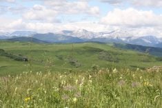
Mountain snow pack ranges from above average to much above average in the Oldman River basin, variable but generally above average in the Bow River basin and average to below average in the Red Deer River basin.
“We are certainly monitoring it across the province, as we do every year,” said Sancartier.
Rainfall historically causes major river flooding, and May and June carry the biggest threats of rainfall causing rapid melt of mountain snow pack.
“High snow pack on its own, we wouldn’t expect widespread river flooding,” she said. “That doesn’t mean there can’t be overland flooding in low-lying areas.”
Reservoir levels in southern Alberta are above average for this time of year at 85 percent in the Oldman reservoir, 53 percent at Waterton and 69 percent at St. Mary’s.
“We would expect the reserves to be at or near capacity by the end of June, after spring runoff has occurred,” said Sancartier.