MOOSE JAW, Sask. – Long, cold, snowy winter; long, wet muddy spring.
The snow that buried the Prairies has begun to melt leaving the West with floods and flood warnings.
Melting has moved east from Saskatchewan’s Wood River and Notukeu Creek systems, threatening, but not drowning, the town of Gravelbourg. Low-lying farms received minor damage in the flat country south of Gravelbourg along the Wood River, say municipal officials. Water has fallen away from the towns of Ponteix and Vanguard in the southwest after washing out roads, stranding livestock and damaging drinking water facilities.
Read Also
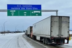
U.S. bill could keep out Canadian truckers
The Protecting America’s Roads Act, which was tabled in the U.S. House of Representatives at the beginning of October, would “rid the country of illegal immigrant commercial truck drivers and ineligible foreign nationals.”
Moose Jaw and area residents are the latest to feel spring lapping at their heels. Late last weekend Thunder Creek rolled through its shallow valley, raising water levels in Moose Jaw where it met with a still partially frozen Moose Jaw River that approaches the city from the southeast.
Ice has restricted flows along that waterway, causing floods across flat farmland extending from Avonlea and Rouleau northwest to Moose Jaw.
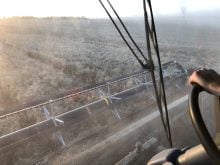
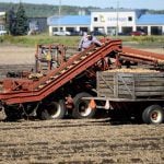
Farmers in these areas have been forced to seek higher ground or navigate drowned roads with tractors, as grid roads are cut to protect farm yards and secondary highways become spillways.
As of March 31, water in the Moose Jaw system had only just begun flowing southeast of Rouleau and heavy snowfalls left a surplus of moisture yet to melt in this area.
“So far the water has been moving in a very orderly fashion, melting west to east and this has prevented a great deal of flooding. If temperatures don’t get too high too fast the Moose Jaw area may be spared,” said Alex Banga, of Saskatchewan Water.
Flood waters were to have peaked in Moose Jaw April 2.
Melting in the Regina area has started but is not expected to peak until next week. A large snowpack and healthy fall moisture conditions are expected to result in flooding of the region for the second year in a row. Melting in the Poplar River region of south-central Saskatchewan has also begun this week and flooding is predicted for the Big Muddy and Missouri systems along the U.S. border.
High water flows are reported in Alberta, but flooding has been limited to small areas in the south. Warm temperatures caused an early spring runoff from melted snowpack. Potential for later spring flooding from mountain runoff still exists.
Manitoba remains the focus of attention as spring melting combined with above average river flows from the U.S. ensure that floods will affect farmland in the Red River and Souris River basins. Farmers have been advised to move grain, feed stocks, equipment and livestock to higher ground in these areas. Throughout the province, higher than normal water levels are predicted.
“Flooding in the Red River Valley could reach the highest levels this century if adverse weather conditions occur,” said Glen Cummings, Manitoba’s minister of natural resources. Flood liaison offices are being established in the Manitoba communities of Melita, Niverville, Russell and Selkirk.