Southeastern Saskatchewan was preparing for a deluge earlier this week as weather forecasters predicted as much as 50 millimetres of rain on top of an already saturated landscape.
Few welcomed the news of any amount of rain after a late April snowstorm dumped wet snow on the region and residents prepared to clean up from previous flooding.
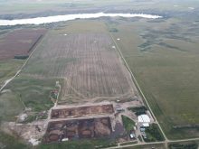
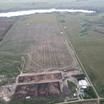
The Saskatchewan Watershed Authority said May 9 the flooding situation had eased, but a heavy rainfall would affect a couple of areas.
The Souris River system downstream of Rafferty Reservoir would likely be most affected, said Doug Johnson of the watershed authority.
Read Also

Agri-business and farms front and centre for Alberta’s Open Farm Days
Open Farm Days continues to enjoy success in its 14th year running, as Alberta farms and agri-businesses were showcased to increase awareness on how food gets to the dinner plate.
Rafferty is almost full and can’t handle more water.
Releases will have to be made depending on where and when the rain falls and its intensity.
“We are anticipating that the flows will increase very significantly through Estevan as we have to pass the inflows,” Johnson said.
“If that happens, we could see water levels rise from where they are at this point in time by as much as a metre. That will have major impacts on the properties that were combating the floods and the infrastructure in the river valley.”
The coal haul road, on which coal is transported from the north side of the river to the Boundary power station, was closed May 9 in anticipation of more water.
The Qu’Appelle River system would also see rising water levels downstream of Katepwa Lake if significant rainfall occurred, which would keep people near Crooked and Round lakes on flood watch.
Johnson said Manitoba would also be affected as the water flows from those lakes into that province.
The Canadian Pacific Railway line from Estevan, Sask., to Boissevain, Man., was closed May 9 because of flooding.
Residents downstream of Rafferty have all been warned to take precautions to protect their property.
Agriculture minister Bob Bjornerud wasn’t spared this spring. He spent last week in rubber boots bailing water after the April storm melt combined with existing water to turn his property east of Yorkton into an island. Three neighbours were also affected.
“We’ve been pumping for four or five days, night and day, trying to keep the basement from flooding,” he said May 6.
“It’s running in just about as fast as you can take it out.”
Provincial parks are flooded and public access will be affected as fishing and camping seasons begin.
Rowan’s Ravine and Katepwa Point provincial parks, along with Regina Beach recreation site, will all be closed until June.
Boat launch and fish filleting facilities at Buffalo Pound, Echo Valley, Katepwa Point, Crooked Lake, Rowan’s Ravine and Regina Beach are all closed until further notice.
Duane McKay, the provincial emergency response director, said wave action on the lakes could cause severe damage to dikes that property owners built.
Meanwhile, residents in the southwest who had been preparing for significant flooding have apparently dodged that bullet.
Johnson said spring runoff flows have dropped off unless a rainstorm develops to cause flooding.
“What’s happening right now is that Agriculture and Agri-Food Canada has started filling up some of their reservoirs in the system for water supply and probably reducing the flows even more through the system,” he said May 9. “We’re not anticipating any problems there.”