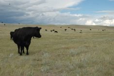
Protecting low-lying agricultural land around Surrey, B.C., is expected to be addressed in a Coastal Flood Adaptation Strategy, now being developed by the city.
Surrey, about 35 kilometres east of Vancouver next to the Fraser River, is situated on the coastal flood plain.
Mike Starchuk, a city councillor and the chair of the Surrey agriculture and food security advisory committee, said they have started to seek input from community members at open houses and have been laying out possible options to protect the land from flooding.
Read Also

Canada to have increased presence at Agritechnica 2025
Interest in diversifying trade markets is taking more Canadian manufacturers to Agritechnica 2025, the world’s largest machinery show.
“When we take a look at the City of Surrey and where its agricultural land sits inside of there, we’re looking at about 20 percent of the land sits inside this flood zone that’s been identified in the next 75 years. Almost all of that land is agricultural in nature.”
He said one option is to build dikes higher to better hold the water inside river banks when river drainage to the nearby ocean backs up because of king tides or closed dams.
“When you take a look at what the ultimate plans might be, it gives you different options and that’s where we’ve been involved as a group with representation from the agricultural community that’s out there to say this is what we want to be able to consider.”
There is also the potential issue of salt water contamination of agricultural land if flooding occurs.
As well, travel through the city and the area would be extremely difficult, requiring long detours, he said.