Researcher will use video game technology to increase understanding of trends on Alberta’s side of the Rocky Mountains
A four-year project will use technology created for video games to help people understand the increasing pressures on water resources in Alberta’s Rocky Mountains.
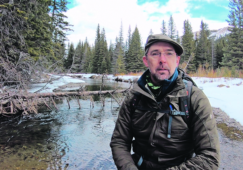
It aims to better explain and monitor snowpack and downstream river runoff in the Eastern Slopes, said Christopher Hopkinson, research chair in remote sensing at the University of Lethbridge.
Although the project won’t specifically look at the impact downstream on farmers and ranchers, the agricultural context is “crucially important to everything we’re doing,” he said.
It is vital to get a better handle on past and future trends in the region in an era of climate change, he added.
Read Also
Farm auctions evolve with the times
Times have changed. The number of live, on-farm auctions is seeing a drastic decline in recent years. Today’s younger farmers may actually never experience going to one.
The Eastern Slopes contain the headwaters of the Saskatchewan River system, which provides water for much of the Prairies. As much as 90 percent of the flow from the headwaters is derived from melting snowpacks, said a project statement.
However, changes in climate and headwater land cover have made the historical relationship between river runoff and snowpack data less reliable, affecting water resource forecasts, it said. A new monitoring and prediction framework “is needed to ensure the security of Alberta’s water supply.”
Hopkinson said the project will use game engine technology to digitally recreate the Eastern Slopes environment in three dimensions with as much realism as possible. It will be similar to the immersive experience of playing a first-person gun or weapons-based video game, with people viewing the data using virtual reality goggles or a computer screen.
“And then we can run simulations to illustrate and educate how that environment can change through time or through the season — or if there’s a wildfire, for example, how would things change?”
One of the project’s goals is to show the weather in the digital reconstruction “happening in real time because we can connect it to real-time telemetry.”
It could eventually include data from provincial monitoring stations in the Eastern Slopes, potentially allowing people to view information on current snowpack and water levels, Hopkinson said.
“Whether that’ll happen, I don’t know. It’s a possible direction we’re going, but it requires the government to say, ‘hey, that’s great. Yes, we’ll do that,’ and we’ll just have to see.”
The project is being funded using $583,000 from Alberta Innovates, a provincial crown corporation. The initiative is being led by Hopkinson and it will include scientists from Alberta Environment and Parks as well as the University of Waterloo in Ontario.
Other partners include Parks Canada officials at the Jasper, Banff and Waterton Lakes national parks in Alberta, along with MacHydro Consultants Inc., Inside Education and Castle Mountain Resort. Virtual reality work will be conducted with Calgary-based Fluid Planet, which has helped with previous projects involving Writing-on-Stone Provincial Park and the Milk River floodplain.
There has been a tendency to treat events in Alberta’s Rockies, ranging from wildfires and insect infestations to coal mining and forestry operations, as isolated problems, said Hopkinson.
“But what we’re seeing is that the Eastern Slopes is under a lot of pressures, and then of course within all that, we’ve got a climate change question, and so it’s essentially quite complicated.”
Rising temperatures are causing glaciers to recede, affecting the flow of water into rivers relied upon by the province’s cities and communities, he said. There has also been a shortening of the snow cover period.
If the snowpack melts earlier and more quickly, it could have implications for filling reservoirs and the availability of water for irrigation, said Hopkinson. Climate change is also increasing the severity of weather events, boosting the chance of droughts and flooding and potentially making reservoir management more challenging.
“So, we don’t know exactly how this will all unfold, but it will get more dynamic, and as things get more dynamic and they happen more quickly, it places more challenges on the decision-making and planning process, so it means we might be playing more catchup and more mitigation all the time…
“And this is one thing we need to wrap our heads around is the level of complexity and how all the moving parts interrelate to one another.”
Although Hopkinson said he hopes the project will be useful to provincial officials and the public, it will be neutral in terms of political issues such as whether to approve open-pit coal mining in the Eastern Slopes.
He welcomed a recent ministerial order by Energy Minister Sonya Savage restricting new coal exploration and development in the region “because I do think there’s a lot we don’t know.”
More information is needed about the potential impact on other stakeholders in terms of the amount of water that will be used by coal mines, particularly in years when snowpack is low.
The impact of water contamination due to potentially toxic levels of selenium from coal development is outside the scope of the project.
As the virtual reality work proceeds with Fluid Planet, researchers are undertaking snowpack operational modelling and vegetation change assessments involving forests and wetlands. One of the challenges is the spread of the monitoring stations, said Hopkinson.
“You go for a hike in the mountains in winter and you’ve got deep snow back over there, and you’ve got a completely scoured hillslope over here with no snowpack, right? It can be very highly variable over a very small scale.”
Scientists will be using methods that combine airborne survey information and satellite imaging. The data will be processed using artificial intelligence to find patterns.