Emergency response times in rural communities continue to improve with advancements in GPS technology, say emergency responders in Saskatchewan.
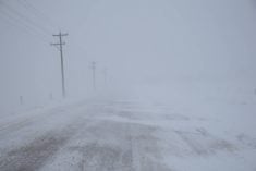
Not long ago, police, firefighters and emergency medical professionals who were called to remote rural locations relied on road maps, signs, landmarks and verbal directions that were passed from callers to dispatchers to emergency responders.
The system worked well but delays often occurred.
However, GPS mapping systems have improved in the last 10 years, making the job of emergency responders much easier.
North Battleford, Sask., RCMP employed a new GPS system that was customized by adding GPS points that correspond with houses, farmyards and other locations of interest.
Read Also
Volatile temperatures expected for this winter
DTN is forecasting a lot of temperature variability in the Canadian Prairies this winter. Precipitation should be close to average.
The points were collected on a database, uploaded onto the GPS system and can be accessed via car-mounted GPS hardware.
Staff sgt. Howard Nodwell said the detachment’s enhanced mapping system allows officers to quickly find locations in rural areas and First Nations communities, which often lack signs, street names and house numbers.
With additional software, the system can also guide emergency vehicles to any legal land location in the province. Similar systems are being used by EMS vehicles and firefighters across the West.
“The system is basically a car-mounted GPS system that allows us to upload specific waypoints that we have mapped ourselves,” Nodwell said.
“GPS technology, when it first came out, was very much geared toward urban centres and well-known and well-marked highways.… But the mapping technology and software has come a long way since then and has basically evolved to a state now where it now suits our needs.”
Nodwell said RCMP officers from the North Battleford detachment did most of the legwork involved in customizing the system.
They also asked First Nations community leaders to provide information on house numbers and other points of interest on First Nations reserves.
He said the resulting system will improve response times and ensure better emergency services for the First Nations communities of Red Pheasant, Mosquito, Sweetgrass, Moosomin and Saulteaux.
The North Battleford RCMP has asked
other emergency operators in the area if they would be interested in using copies of the enhanced system.
“We have shared this system with other emergency personnel, such as ambulance, so it can assist them in locating residences throughout the area more quickly as well,” he said.
Improving emergency response times is a goal of most emergency responders in Western Canada.
In Saskatchewan, a review of EMS services completed late last year suggested 15 percent of rural and remote Code 4 calls have response times of 30 minutes or more.
A code 4 call is an emergency that involves lights and sirens.
The report said there are specific challenges involved in responding to emergency calls originating in rural, remote and northern communities.
“The vast distances between rural communities in Saskatchewan, in conjunction with the relatively low population density, leads to challenges in providing a high-quality EMS service in a timely manner,” the report said.
Steven Skoworodko, vice-president of the Saskatchewan Emergency Medical Services Association and owner of Wakaw Ambulance Care, said it is unclear how many ambulance vehicles are using GPS.
Retail GPS systems such as Garmin offer a significant improvement over maps and road signs, he said, although most vehicles still use road and rural municipality maps as a backup.
In Wakaw, ambulances are outfitted with Garmin units that show most grids and back roads.
The systems can also be upgraded with FarmTrax software, which contains information on all legal land locations, including the names of landowners and the locations of their primary residences.
FarmTrax software is available for most rural areas in Western Canada and is updated regularly.
“It definitely makes the job easier, especially if you have somebody that’s new and doesn’t necessarily know the area,” Skoworodko said.
“It’s just another tool that we use. We still usually confirm on a map … but the GPS definitely does make it a lot easier and simpler to find a location.”
Skoworodko said some EMS operators are now moving to GPS technologies that include automatic vehicle location, which allows dispatch agencies to monitor the progress of an emergency vehicle as it travels to its destination.
In the past, emergency operators have called for a universal platform that could be used by all emergency vehicles.
In the absence of such a platform, response vehicles are adopting their own systems, which could lead to significant differences in service standards.
Paramedic Ray Francis from Moose Jaw, Sask., agreed GPS systems have come a long way and have helped emergency response vehicles find their destinations.
However, he said improved signs on rural roads offer another level of assurance to responders who are working under tight timelines and stressful conditions.
“Response times have been a concern for a number of years and GPS is certainly helping out an awful lot, but without roads being properly marked, it can still be difficult,” said Francis, a farmer and director of community relations and training with Moose Jaw and District EMS.
“We always seem to get where we need to go but there are times where it certainly would be quicker … if we had better markings on roads.”
Several RMs in the Moose Jaw area are using a municipal road mapping and enhanced sign program that provides standardized signs.
Enhanced signs are located along roadways, at intersections and at all lanes and farmyards.
Participation in the program has been hit and miss in Saskatchewan, Francis said. Some RMs feel the cost of the additional signs is prohibitive.
“Certainly it helps to know that if you’re supposed to go to Road 54, for example, when you get to that sign you know you’re at the right road,” Francis said.
“It’s always a bit of a guessing game. Most often you guess correctly but you’re never really sure.”