2,000 FEET ABOVE MELITA, Man. – He had been talking for weeks about the vast acreage that farmers would not be able to seed this year because of flooding and saturation, but that didn’t stop Doug Chorney from being stunned when he saw the evidence from above.
“Holy mackerel, look at how wide that is,” the president of Keystone Agricultural Producers exclaimed as he saw the massive sprawl of the Souris River and the plain of brimming potholes and new lakes in the Melita area.
Chorney took a flight over much of rural Manitoba yesterday to get a sense of the extent of flooding and prevented seeding, and nothing he saw reassured him that the situation was better than he thought or was improving.
“Most of this won’t dry this summer.”
In a flight that went from Steinbach to Melita to Reston, then up along the Assiniboine River Valley and east past Dauphin, Dauphin Lake, Lake Manitoba and through the southern Interlake, almost no farming activity was visible.
Only one sprayer could be seen on the entire journey, and that was in the one good patch of farmland east of Winnipeg. The rest of the flight revealed nothing but unseeded fields – often with a green flush of weeds – fields semi-seeded by creative tractoring around wet patches and big new lakes where none appeared on the map.
Seeded fields were a minority except in the Steinbach and Selkirk areas, and those appeared to be mostly just-emerging crops rather than the robustly growing crops that are typical in late June.
Much of Manitoba and southeastern Saskatchewan have suffered an appalling seeding season, with soil saturated from last year being made unfarmable by continuing showers and cool temperatures that have prevented drying.
With most crop insurance deadlines now passed, most of the unseeded acreage will not be planted to a crop this summer.
From Steinbach, where seeding progress is relatively good, conditions get worse toward and west of the Red River, which flooded this spring and soaked the soil. Further west, pools of water and a sheen can be seen across much of the area. Anything near a drainage system hasn’t been seeded.
The area near the Assiniboine River is deluged in many places where the river has spread wide.
Toward Melita, the situation becomes stunning, with the river expanding far beyond its banks and filling the valley in many places. Big plains of water exist in a number of areas, sprawling across fields that are usually farmed.
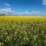
Weed growth is rank across the wet wasteland. Green and yellow flushes suggest growing crops, but a closer look reveals that most of the vegetation is nothing but weeds and volunteer plants.
The Assiniboine Valley north of the Trans-Canada Highway is often more like a moving marsh than a river, with the channel well beneath the level of the water.
Lakes Dauphin and Manitoba have spread wide, swallowing much farmland and pastureland. Lines of trees reveal where the shoreline should be in many places.
Across the Interlake, little appears to have been seeded. The area has suffered for years from excess moisture.
As Chorney got out of the small plane after the four-hour trip, he noted simply, “It’s hard to believe.”


