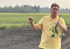
Watching the jet stream Meteorologist Drew Lerner has good and bad news for prairie farmers for this spring, summer and fall
What happens in the U.S. rarely stays in the U.S.
Examples include low interest rates and difficult borrowing conditions, reduced Canadian exports because of American financial wrecks and high agricultural commodity prices caused by American corn-for-fuel policies and short U.S. grain supplies.
But does it have to be the weather, too?
This year’s predictions for good growing conditions on the Canadian Prairies might be affected by what happens in the United States.
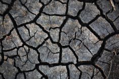
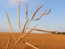
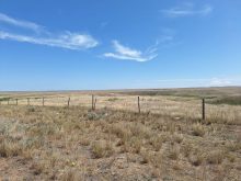
If last year’s drought continues on the U.S. Plains, it might affect conditions in the Prairies this summer, says meteorologist Drew Lerner.
Read Also

Farming Smarter to hold Agronomy Battles series
Southern Alberta non-profit research institute hope grassroots sessions with producers help focus future research on cover crops, strip tillage and herbicide resistance
Lerner, who heads World Weather Inc., thinks Western Canada should experience average weather conditions this spring: a moderately dry April and May, ideal for seeding, followed by a slightly cooler than average summer, with a typical rainfall pattern. The fall will most likely be wetter than usual.
The spoiler could come from another year of drought that stretches from Texas north to the Dakotas and covers the central U.S. from the Rockies to western Iowa, stopping short of the corn belt.
A large, high-pressure ridge will develop over the central West at some point during the summer.
It lasts for awhile in a normal year, when there is some moisture on the ground, but eventually falters as surface moisture evaporates, rises and disrupts the atmospheric formation.
Left alone, the ridge produces intense heat and drought and can spread north if it becomes large and stable enough, keeping rain and other cooler, crop-beneficial weather from developing in Western Canada.
Lerner said a combination of factors are conspiring to continue the American drought west of the corn belt, from the 18 year jet stream pattern to the effect of solar spot activity, as well as other more terrestrial issues.
The formation of one of those large, stable high-pressure ridges would result in a 30 percent chance of a mid-summer’s drought in the southern Prairies.
Those ridges tend to deliver cooler, northern air to the Prairies when they form further south or remain unstable, bringing with it the precipitation and lower evaporation rates that will favour crop development and higher yields.
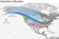
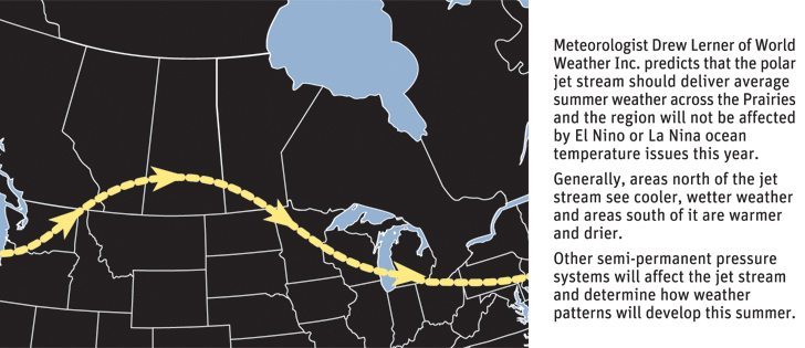
The jet stream pattern that will dominate the summer will enter North America over the U.S Pacific Northwest and move gently to the north, passing over the grain belt in southern Saskatchewan and dipping down through the Dakotas and Minnesota.
“It’s generally a good signal for grain production out here,” Lerner told the Saskatchewan Institute of Agrologists seminar held during last week’s Crop Production Show in Saskatoon.
He said weather tends to create patterns that are somewhat repeatable but not too predictable because there are so many factors at play.
Considering all the variables that can occur in weather, all meteorologists can do this far ahead of seeding is create forecasts by marrying the science to historical data and their own research and experience.
Brian Fuchs of the National Drought Mitigation Center at the University of Nebraska said most of the drought regions have poor moisture levels. It is unlikely that those states will able to overcome their significant moisture deficit by spring and summer.
Lerner said a continued drought in the U.S. would be key to what happens in Western Canada.
“If the Plains and (West) don’t get out of their soil moisture deficit by then, there won’t be enough moisture in that region to disrupt the high pressure ridge,” said Lerner.
According to last week’s Drought Monitor report, 86 percent of the Great Plains is in a severe drought, and the vast majority of that was classed extreme.
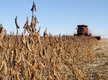
Last week’s U.S. Department of Agriculture meteorologist report by Brad Rippy reported that 60 to 72 percent of the region’s hay and cattle land was in a drought situation.
The department has listed more than 350 of the 525 counties in the north-south wheat belt that runs from Texas through North Dakota as in drought.
That resulted in the USDA declaring the middle and southern part of the region a disaster area, making those producers eligible for low interest loans and other federal benefits.
“That’s why I provide forecasts on a bi-weekly basis,” he said.
“This year should be a good one for farmers, but it will depend on a lot factors and on a location by location basis.”
Snow covers most the Prairies, but it carries little water: a few tenths to a half an inch at most this year. The November to early January period is in a moisture deficit, despite some rain that fell between October and December.
“It will be enough in most cases to get the crop in and started, but in many areas they will be looking for timely rains in June and July to fill it out,” Lerner said.
He said there is a 70 percent chance the jet stream pattern will benefit the Canadian Prairies this year with a slightly wetter, cooler summer.
“I think this bias will be helpful to most of you guys. Late April and May there will be a warmer bias to the southwest, meaning in Alberta and western and southwestern Saskatchewan. In the northeast and in Manitoba it will be biased to the cooler side,” he said.
“It will come down to how dominant this 18 year cycle (of the jet stream) is. So far this winter it’s pretty reliable. In the past it generated a slightly cool and dry winter, and that is just what we are having here (on the Prairies).”
He said 1959 was the fifth driest year, 1977 was the 16th and 1995 was 12th in the 64 years that the 18 year cycle has been tracked.
However winter cycles are more reliable than summer ones, Lerner added.
For example, 1959 was the 29th warmest, 1977 was the hottest and 1995 was 23rd wettest. Further complicating the trend was that 1959 was fifth driest, 1977 was the ninth wettest and 1995 was 23rd wettest.
El Nino and La Nina affected some of those years.
A significant American drought in 1977 stretched from California to Alberta. A high pressure system became stalled that summer and diverted rain north, according to American weather records.
A mild El Nino was in place for 1959 and 1977, and 1995 was a moderate El Nino.
Summer should be more predictable without those ocean effects, he added.
Lerner said drought might be in the forecast next year as well, considering that 1960 was droughty in the U.S. West and Western Canada.
While last year was similar to 1934, Lerner said 1935 was a wet year. Unfortunately for those who base their predictions only on weather history, 1936 was another terrible drought for most of North America.
“This summer, the more rain that falls in (the U.S. wheat belt), the less you will get. But of course, forecasts get more accurate as we get closer to the date,” he said.
Lerner said with some confidence the fall will be wet and cool, and producers should plan their planting accordingly.
What is the jet stream?
The jet stream is a narrow current of relatively strong winds concentrated in the upper atmosphere. It exists where cold polar air and warm air masses are in contact.
Encircling the globe at altitudes of nine to 13 kilometres above sea level in segments thousands of kilometres long, hundreds of kilometres wide and several kilometres thick, the jet stream flows west to east in curving arcs as it undulates north and south. The jet stream is strongest in winter, when core wind speeds can reach up to 400 km/h.
Across North America, the polar jet stream is an influential factor in daily weather patterns. Changes in the jet stream indicate changes in the movement of weather systems and thus changes in weather.
Source: Environment Canada