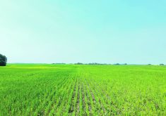
BRANDON – If a field slopes north but you run your drainage south, there are bound to be problems.
It’s not a unique situation, says Simon Knutson of SK Mapping & GIS Services.
Knutson, who produces elevation maps and drainage prescription maps for Manitoba and Saskatchewan farmers, said he’s no longer fazed when he maps a field that’s been drained for decades, only to find that farmers have been trying to make water run uphill.
“We’re not surprised anymore, but we generally find that farmers are very surprised with what we find,” he said. “We did a 400 acre field up in the Interlake last week. All the water was flowing the complete opposite way to what he had thought. The RM put culverts under the road at the south end of the field, but when we mapped it, all the water was flowing north. We thought it looked like it flowed south, too, until we drove it with the quad. Then we got some … high (resolution) aerial photos from 2008 and that confirmed that it drained to the north.”
Read Also

VIDEO: Green Lightning and Nytro Ag win sustainability innovation award
Nytro Ag Corp and Green Lightning recieved an innovation award at Ag in Motion 2025 for the Green Lightning Nitrogen Machine, which converts atmospheric nitrogen into a plant-usable form.
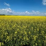
During an AgriTrend field day last month, Knutson translated a satellite photo of a canola field taken the day before. He overlaid the 30 metre pixel satellite image with his topographical map and the drainage prescription.
“First thing in the morning, I translated the sat image into NDVI (Normalized Difference Vegetation Index). From that, I was able to divide the field into four distinct vegetation zones. The AgriTrend team then took my NDVI information and created a variable rate fungicide map for the field where we had the demo that afternoon.”
All this data manipulation took only a few hours, and no time wasted driving to the office. Knutson and the AgriTrend advisers performed the work in the field on laptop computers.
Every field he drives is geo-referenced, so Knutson’s images are quickly overlaid with images from other sources.
Knutson said the Outback-based RTK system costs about $25,000 plus the cost of the all-terrain vehicle.
Although Outback is only single frequency RTK, he said it seems to work fine.
“We’ve done several tests and so far we haven’t found any need to spend twice as much money on a dual frequency system.”
He sets up the typical tripod tower at the field edge. The GPS receiver is strapped to the front of the quad and the laptop is strapped to the back. Elevation is logged wherever he drives in the field.
Knutson charges $10 per acre, which provides the client a topographical map and a drainage prescription map complete with ditch routes, depths and gradients.
For more information, contact Simon Knutson at simon@gis4ag.com.