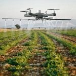
The Manitoba Forage and Grassland Association’s Green Gold program has a new tool to help growers determine their best hay day — unmanned aerial vehicle imaging.
Now in its 21st year, Green Gold provides timely information to MFGA members so that they can maximize their hay quality by harvesting at the best time.
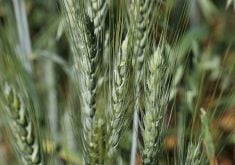
Hay day is the date when first cut pure alfalfa stands are at their optimum quality of 150 relative food value (RFV).
The date is different each year, depending on the weather, so alfalfa samples are analyzed semi-weekly leading up to the cutting day recommendation.
Green Gold has built a sizeable database detailing the factors that dictate the best hay day, and the MFGA now wants to see if 21 years of ground truthing can convert into a more efficient predictor based on aerial imaging using drones.

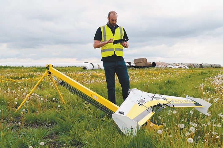
Matthew Johnson, owner of M3 Aerial Productions in Winnipeg, flew the fields this year. He used his AgEagle RX60 fixed wing UAV in June to take aerial images, which were then compared to the association’s cutting results from the same alfalfa fields.
The experiment was intended to determine how closely the NDVI aerial images correlated to cuttings on the ground.
A close relationship would mean Manitoba alfalfa growers could be cutting their alfalfa on the best day rather than after the best day.
M3 Aerial flies drones equipped with the MicaSense, Sequoia and RedEdge sensors. Its software geo-references factors such as plant height, plant count, plant health, biomass estimates, disease, weeds, plant nutrition and estimates of volumes of piles, patches, holes and hills.
Read Also
Growing garlic by the thousands in Manitoba
Grower holds a planting party day every fall as a crowd gathers to help put 28,000 plants, and sometimes more, into theground
It also renders 3D topographical maps and creates false colour elevation maps to design drainage systems.
Johnson’s RX60 fixed wing drone is capable of capturing up to 640 acres of cropland per hour.
The Green Gold program takes alfalfa samples at 8 a.m. on Mondays and Thursdays and delivers them to the lab for analysis before 11 a.m. the same day.
Regional results are emailed to subscribers twice a week. The list of 500 subscribers consists mainly of forage growers but also dairy, beef and sheep producers and industry officials.
Johnson flew his drone over some of the sample sites this year at approximately the same time the samples were being cut.
Green Gold co-ordinator John McGregor said this year’s weather had a big impact on the timing of hay day.
“Due to unusual environmental conditions with cool weather and extreme warming conditions, we have seen alfalfa reach optimum quality well before the traditional early bloom (10 percent flower) stage,” McGregor said.
“In most cases, had producers waited for the crop to show these signs, harvest would have been delayed by up to two weeks and the RFV would have been in the 110 range.”
This year’s project was somewhat backward to the way most aerial imaging projects unfold.
Typically, a project co-ordinator takes a set of fresh aerial images and then goes about trying to ground truth them. In this case, the MFGA was in the enviable position of already having 21 years of plant analysis data before the drone even took to the sky.
The question now is whether there is a solid connection between existing data and fresh aerial images.
“Right now, we’re just exploring this idea,” McGregor said.
“We’re not 100 percent certain that we’ll be able to extrapolate the kind of information we want.”
For more information, contact McGregor at John@mfga.net and Johnson at 204-800-0220 or visit www.m3aerial.com.