We had a fairly major storm system on the Prairies last week, but it was not strong enough to warrant major attention. Manitoba received the most moisture from this system, with widespread 20 to 30 millimetres of rain mixed with snow. The northern half of agricultural Saskatchewan, along with the far eastern regions, also saw […] Read more
Tag Archives Weather Vane column — page 7

How did this winter’s weather stack up?
When you hear statistics about winter, the data usually describes meteorological winter — December to the end of February. In some parts of North America this makes sense, but in our part of the world, not so much. I often discuss our winter in terms of the extended winter, the months when we actually see winter conditions across the Prairies. That span […] Read more

March and February swapped temperatures
March across the Prairies was almost, but not quite, a weather reversal of February. Last year, June had average temperatures equivalent to July’s, and July had average temperatures more like June. We didn’t quite see that in March, but in some locations, March was a little colder than February. The strange weather continues. March was colder […] Read more

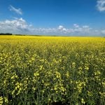
Why is the sky blue? It’s all about solar radiation
A young reader asked recently why the sky is blue? And as part of that, why is it not blue early in the morning or evening? To begin, we need to look at what happens to the incoming shortwave solar energy as it comes into contact with Earth and then goes through the different layers […] Read more

Albedo has big effect on spring warming
Two factors determine spring warming: the natural cooling effect of snow cover and the bright snow reflecting sunlight back into space, also known as albedo. A good portion of the sun’s energy that reaches Earth is simply reflected away, never getting the chance to do any work. On average, over a whole year, the Earth […] Read more

Warm weather must wait for the snow to melt
The toughest part of spring forecasting is considering snow on the ground and how it will impact temperatures. In a typical year, when there is widespread and fairly deep snow cover, this can be a little easier. Even then, the forecast will often call for warm temperatures with highs of 6 to 8 C and […] Read more

Prairie snowpack is beginning to accumulate
I have been accused of it, but I am not a weather sorcerer! Yes, I talked about the history of big spring snowstorms, and delayed talk about lack of snow cover this winter, but that doesn’t mean I had anything to do with the snowy conditions across much of the Prairies in recent weeks. But […] Read more

Wild winter continues with warm February
In my January weather review, I said 2024 might be a wild year after the rollercoaster ride of January. Well, the wild weather continued, with spring-like temperatures into February and a cold and snowy end to the month. As we head into March, I wonder if we will see another flip like we saw last […] Read more

Looking back at spring snowstorms of yesteryear
Most of us are hoping for snow this spring. Here’s a look by province at what’s happened in the past. Over the last 140 years, Winnipeg has recorded 20 centimetres of snow or more on a single day in March at 12 different times. The most recent was March 8, 1999. The largest March snowstorm […] Read more

Tonga eruption not main cause of record heat
In the last article, we discussed the way volcanoes can impact day-to-day weather and also the climate of the planet over extended periods of time. Volcanoes, for the most part, have a cooling effect on our planet. The ash and sulfur dioxide propelled into the atmosphere from the eruption tend to block incoming solar radiation, […] Read more