What this summer’s weather holds for producers was a hot topic during the Canadian Cattlemen’s Association’s first townhall of 2022 with meteorologist Matt Makens outlining the latest predictions.
Makens said sea surface temperatures remain colder than average, especially in the Gulf of Alaska, that will see storm systems draining them of their humidity as they move from the West over Canada and the northern United States.
“Because the gulf is so much colder, it’s really robbed us of a lot of that value in moisture,” he said.
Read Also
Manitoba extends Crown land rent freeze
Manitoba government links the continued rental rate freeze on grazing and forage leases to economic and environmental challenges facing the industry
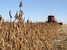
As for the southern regions of the U.S., the spring is not off to a good start with dry conditions persisting across the western half of the country.
“The drought across California — most of those hay and alfalfa areas — are pretty bad. Texas is also quite bad,” Makens told producers.
Satellite data showing plant health across the western U.S. also reflect a continuation of tough conditions.
“The drought across the region continues to negatively impact all growing conditions into the start of our spring year,” he said. “We’re looking at vegetative conditions in the bottom half — the lowest half — in the past 40 years.”
Makens said back-to-back La Niña events caused by cooling of Pacific Ocean surface water temperatures have led to the situation.
“This will be an impact on the American corn belt this growing season — drought for much of it — as well as hay and alfalfa growers. Yet again another year where things are going to be poor for most of those producers, I’m afraid,” said Makens.
In Canada, moisture has reached northern Alberta and Saskatchewan and is tapering into much of Manitoba.
While it’s early, those regions look good for moisture, according to the latest data, Makens said.
North of a line of moisture hitting Western Canada diagonally from Fort St. John, B.C., running through Edmonton and Saskatoon before hitting Winnipeg is looking good. However, south of that boundary is a different story.
“That’s common for La Niña years,” said Makens. “However, La Nina used to carry a lot more water with it.”
But the conditions in the Gulf of Alaska prevented that this past winter, a trend that has been developing with the weather event over the past two decades.
The dry conditions persist in southern Saskatchewan and Alberta running south and east from Calgary to the Manitoba border.
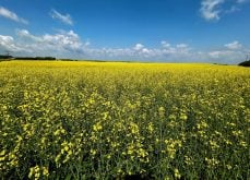
As for the summer weather predictions between April and August, based on his analysis of historical and current conditions, it shows British Columbia as likely going through another dry summer and wet periods for the Prairies and around the Great Lakes.
“Our best chances for moisture will come in May,” said Makens. “The exception will be the far West Coast.”
As for June through August, traditionally drought-prone regions of southeastern Alberta and southwestern Saskatchewan will likely continue to see dry weather.
“Drought needs drought. It’s a cycle. It takes a lot to get over a drought so plan on more drought conditions there,” said Makens. “Water likely to the north where it has been most of the winter.”
Temperatures will likely again be higher than normal in B.C. through southern Alberta and Saskatchewan, he said.
“Probably not the best news for the drought area.”
Makens said his summer predictions are in the 70 percent confidence range with conditions subject to change as the spring moves into summer.
“We may see a wetter period off to the east or even for the Prairies but right now we do not have that,” said Makens.