The toughest part of spring forecasting is considering snow on the ground and how it will impact temperatures. In a typical year, when there is widespread and fairly deep snow cover, this can be a little easier. Even then, the forecast will often call for warm temperatures with highs of 6 to 8 C and then they don’t happen. Why do we see these types of forecasts?
Forecasts by Environment Canada, three to five days in advance, are generated solely by computer models, and they are not always reliable.
Read Also
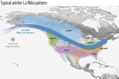
Volatile temperatures expected for this winter
DTN is forecasting a lot of temperature variability in the Canadian Prairies this winter. Precipitation should be close to average.
This is where the human factor used to step in. The models would generate a forecast and then meteorologists would analyze it and use the “art” of forecasting to make changes. The art of forecasting is an intangible skill that incorporates gut feelings and intuitions that people have and may never be duplicated in computers.
This missing art accounts for lack of precision in our medium-range forecasts and often gives rise to erroneous claims of balmy weather in early spring.
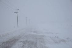
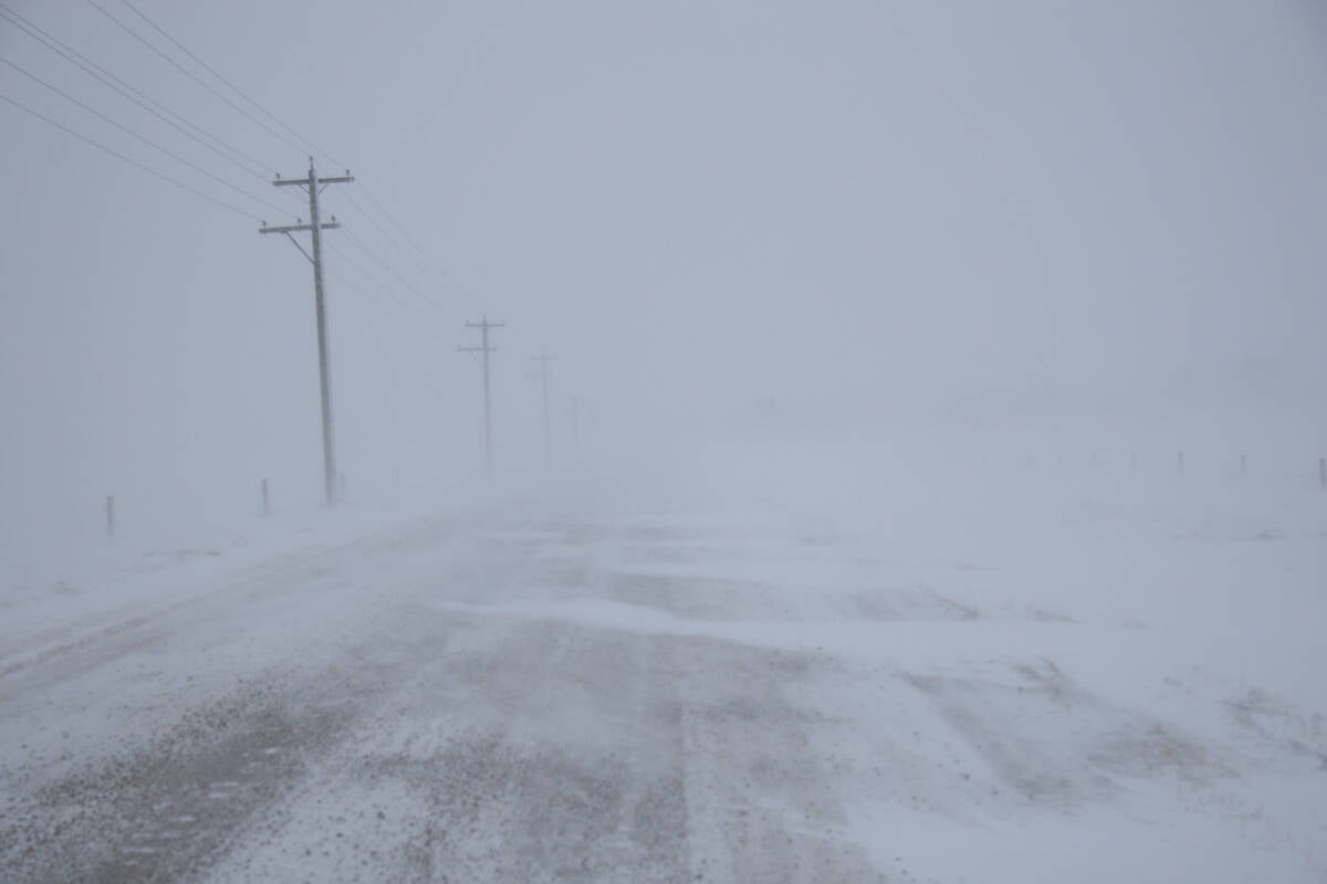
This year has been a bit of an anomaly. Snowpack varies widely across the Prairies, often over relatively short distances. Daytime highs are often warmer than forecasts as weather models struggle with the unique snowpack. The models tend toward a normal snowpack and so far, they’ve often underestimated temperatures.
Let’s go back to a regular snow year. Why do the models often over-predict warm temperatures, especially at this time of the year? The basic answer lies with the snow, literally.
How many of us have gone out on a warm spring day to the local swimming hole or lake? What did you experience? I bet if there was a wind blowing off the lake, you noticed how much colder it felt. The cold water and ice on the lake cools the air around it. The same thing holds true when there is snow on the ground.
Snow acts in several ways to keep temperatures down. First, snow is cold by definition. Changing a solid to a liquid requires energy and in this case the energy is heat. Also, snow is usually white and white objects reflect sunshine.
So, if we have a large area covered in snow, and above-zero air moving into that region, the snow itself cools the air that comes in contact with it. As the heat of the air interacts with the snow, that heat melts the snow instead of warming the air, and it takes a lot of heat to melt snow. In fact, it takes almost as much heat to melt snow as it does to bring water to the boiling point.
There will always be exceptions. If very warm air is pushed into our region and wind mixes up the atmosphere and prevents the snow from cooling the layer of air next to it, we can see some very warm temperatures even with good snow cover. While this is fairly rare, it does occur, especially where the topography helps to mix the air.
The effect of snow acting like nature’s air conditioner can easily be seen when you examine temperature records. Even if you had no idea whether there was snow on the ground or not, in most years just looking at daily temperature records will show you when most of the snow has melted.
For an area to get consistently above zero, there cannot be snow on the ground. In some years the effect is so dramatic that you can see a jump of five to six degrees in mean temperature over a couple of days as the snow finally disappears.
So, if you’re looking forward to warmer days that consistently stick around, relax and wait for the snow to disappear.
Daniel Bezte is a teacher by profession with a BA in geography, specializing in climatology, from the University of Winnipeg. He operates a computerized weather station near Birds Hill Park, Man. Contact him at dmgbezte@gmail.com.