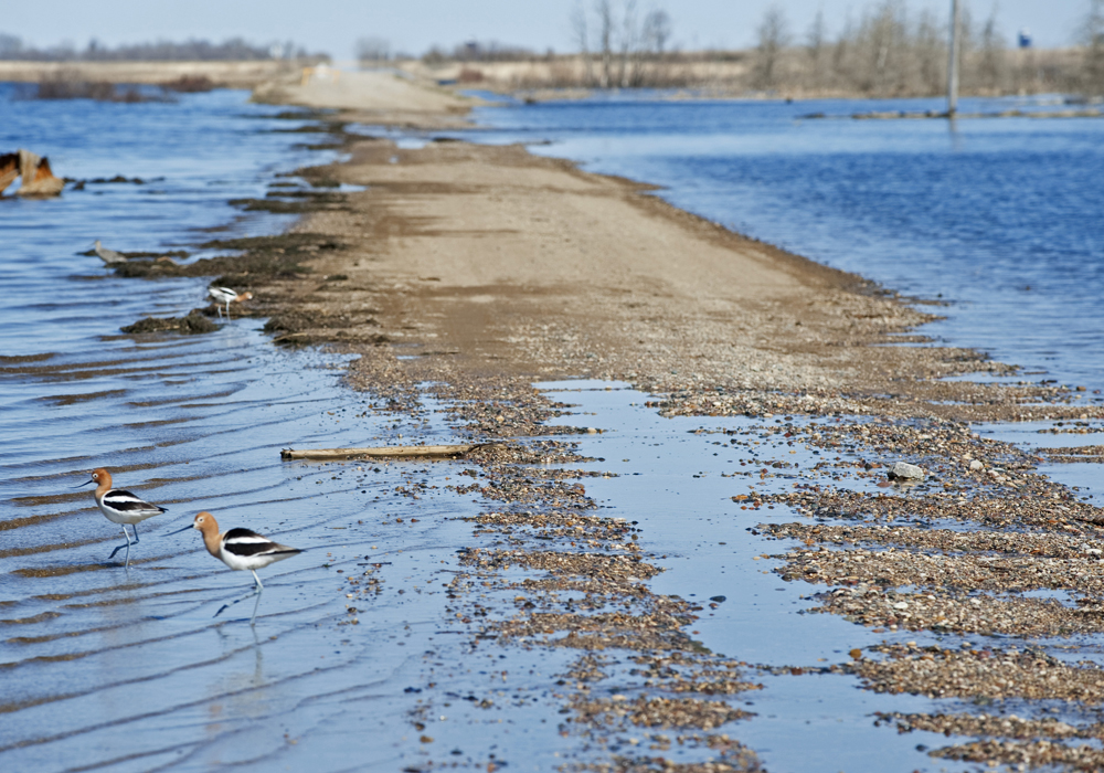
If there is a blizzard in March or spring rains combined with a fast melt, there is a genuine risk of major flooding this year in southern Manitoba.
The Manitoba government and the United States National Weather Service have both predicted increased risk of flooding on the Red River in 2019.
If weather conditions are unfavourable, Manitoba forecasters are expecting a spring flood similar to 2009, a year when 1,000 sq. kilometres of agricultural land were covered in water south of Winnipeg.
Snowfall has been average to below average in most of Manitoba this winter. It’s a different story south of the border.
Read Also

VIDEO: Case IH reveals new Optum tractor at Agritechnica 2025
Case IH reveals its new Optum tractor at Agritechnica 2025.
Snow depths are above normal and the area around Fargo, North Dakota, has received 150 to 200 percent of normal precipitation since Nov. 1.
As well, soil in North Dakota and Minnesota remains frozen because of extreme cold in January and February.
“Frost depths of three to four feet (one metre) have persisted,” the NWS said March 6. “This (could) … lead to a higher potential for runoff due to the frozen ground, especially if the melt is sudden.”
A 2009 scenario would be an extreme event. That year, the Red River recorded the second highest flows in the last 150 years, second only to the 1997 flood.
The amount of water sounds worse than the actual impact.
Following the 1997 flood, homes and properties in the Red River Valley were built up with earthen mounds to withstand flooding.
As well, it’s believed that the area’s drainage system can quickly remove water off agricultural land.
Flooding is less likely in other parts of the province.