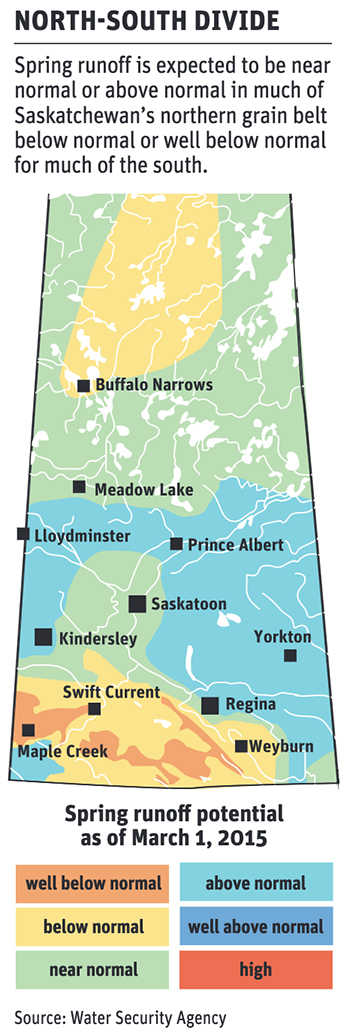
Saskatchewan’s Water Security Agency has released its latest provincial spring runoff forecast and map for 2023.
The map, released March 9, shows “near normal” or “above normal” spring runoff potential for much of the province’s grain growing region.
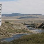
However, a significant portion of the province’s southern and southwestern crop producing region, encompassing Swift Current, Moose Jaw, Weyburn, Estevan and most communities lying to the south, remain “below normal” or “well below normal.”
The forecast was based on conditions observed as of March 1.
“Moisture conditions across southern Saskatchewan were generally dry at freeze-up in 2022, particularly on the west side of the province where drought conditions were prevalent,” the WSA said in a news release.
“Winter snowfall has ranged from below normal over much of southwestern Saskatchewan … to well above normal through much of central Saskatchewan,” it added.
Assuming near-normal conditions over the coming weeks, the agency does not anticipate flood-related issues, even in areas where above normal runoff is forecast.
Warmer than seasonal temperatures across much of southern Saskatchewan in February has resulted in a nearly complete melt of snowpack across much of the province’s southern grain belt, the WSA said.
With the exception of a small area in the province’s extreme southwest — south of Cypress Hills — farmers and ranchers in province’s southwest and south-central grain growing and grazing areas saw limited snowpack this winter, suggesting a continuation of soil moisture deficits for many producers.
Heavy snowpack south of Cypress Hills will likely result in above normal snowmelt runoff in that area.
The WSA published a preliminary spring runoff map in February.
The most recent map includes data from late-February snow surveys. For that reason, the WSA attaches a higher level of confidence to the current forecast and map.
The agency monitors snowpack, water and runoff conditions throughout the spring melt period and provides updates as situations develop.
The next spring runoff forecast will be issued in early April, available on wsask.ca.