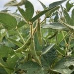
Land along the corridor between Calgary and Edmonton can cost up to $100,000 per acre, hindering conservation
EDMONTON — It is not uncommon to see Alberta farmland between Calgary and Edmonton sliced and diced into small pieces amidst sprawling suburbs, businesses and energy installations.
“From Google Earth, the province looks pretty spacious, but as you zoom in further, looking at the city boundary of Calgary, it doesn’t tell you where the delineation between urban and rural begins,” Peter Woloshyn, head of the province’s Natural Resources Conservation Board, told the Alberta Land Institute conference held in Edmonton May 4-5.
The problem of farmland fragmentation and burying high quality soil under shopping malls is a hot topic in Alberta, but the solution remains elusive.
Read Also
Equipment manufacturing may return to Canada
Some ag equipment and automotive manufacturers are now adjusting their production and distribution to avoid tariff costs in relation to supplying the Canadian market.
Ongoing studies show land is being gobbled up between Calgary and Edmonton in what is known as the Highway 2 corridor.
However, other places have seen limited development, and more farmland has been added in some areas when public land was sold.
The provincial land use framework encourages municipalities to minimize conversion of agriculture land to other uses, but little information is available about how or why this should be done.
“We have a policy environment with little focus on conservation of farmland,” said University of Alberta researcher Brent Swallow.
He is part of a research team that found that more than 233,500 acres were changed from agriculture use to other purposes in the counties surrounding Edmonton from 2000-12.
The Calgary regional partnership area converted 80,500 acres in the same period.
The result was a permanent net loss of 200,000 acres, or .4 percent of the agriculture land base, from 1996-2009, said Jason Cathcart, manager of land use policy for Alberta Agriculture.
“Of that loss, 85 percent of it occurred in the Edmonton to Calgary corridor,” he said. “That is a significant, localized area of loss, and of that, 95 percent of that land was …prime agriculture lands.”
Swallow’s research included focus groups and surveys. Most people living in the Edmonton region thought there wasn’t enough natural areas and probably too much urban development.
People said they rate local food production as important and sensed that agriculture land improves air quality and water purification.
Eighty percent of those polled said they could accept a one-time $25 increase on property taxes or rent to raise $10 million for conserving farmland. Most of them favoured more vegetable production over livestock and grain. They also wanted to be able to see actual farms outside city boundaries.
Twenty percent said they were not interested in farmland conservation.
Another study asked where conservation should start and how much it might cost.
Swallow said it would be costly to buy land and keep it in agriculture because land in the Highway 2 corridor can cost $3,000 to $100,000 an acre.
More research is needed to understand farmer attitudes about conservation and financial incentives.
A three-year study from the Alberta Land Institute looked at the economic, social and environmental costs associated with farmland conversion from 2000-13.
“Over that time period, the data suggested about 127,000 hectares (313,823 acres) of land went from agriculture land to development purposes, and that is about .8 percent of the original inventory of agriculture land that existed in 2000,” said University of Alberta researcher Scott Jeffrey.
“Over that time, the area of cropland actually increased slightly from about nine million to 9.8 million hectares (22.24 to 24.22 million acres). If we focus on cropland, there was no difference, while there was a loss of pastureland in that time period.”
Development looks different across the province. More land has been lost around Edmonton and Calgary while the rest of the province has not changed much.
Less than one percent of land was converted from agriculture to development in 13 years, but it was 2.6 percent in the Highway 2 corridor during the same period.
In some cases, natural areas such as forests, grassland and shrub land were turned into cropland.
“The results are somewhat inconclusive, but the data suggests the rate of fragmentation in Alberta actually went down between 2000-13,” Jeffrey said.
“It is a difficult thing to measure.”
The province comprises 66 million hectares (163 million acres), and while there has been a large gain in rural residential development, farmland area remains stable.
The province estimates that 51.92 million acres were used for agriculture in 2011 and 51.95 million acres in 2015.