(Reuters) — Market bulls have been licking their chops over somewhat valid predictions that the U.S. corn and soybean crops may face weather hardships this summer.
However, they should not go all in on that notion just yet.
Central to these predictions of potential summer drought is the expected mid-year flip from El Nino into La Nina, which has coincided with weather problems in the past, such as in 1988 and 2010.
However, the transition by itself is simply not enough to place high risk on the U.S. summer.
Read Also

Using artificial intelligence in agriculture starts with the right data
Good data is critical as the agriculture sector increasingly adopts new AI technology to drive efficiency, sustainability and trust across all levels of the value chain.
Several atmospheric components factor into summer weather outlooks, and they do not necessarily run in tandem with El Nino or La Nina patterns, nor are they always linked to one another. And not all of the individual components are pointing the same way at the moment.
It is too early to say with certainty what the summer weather will be like anywhere on the globe, but there is some indication right now that the scales are somewhat tipped in favour of warmth in the United States.
A large pool of warm surface water, affectionately coined “the blob,” dominated the northeastern Pacific Ocean near the Gulf of Alaska from mid-2013 through late last year, However, its reign has ended, and this could allow for a hotter U.S. summer.
The blob owed its existence to a persistent ridge of high atmospheric pressure over that same region, and together the ridge and blob amplified the jet stream pattern over North America during their 2 1/2 year residency.
Under the “blob regime,” the jet stream was forced up and over the ridge near Alaska, tipping it on its axis and sending air plunging down toward the United States. When the jet stream, or dominant airflow, is oriented north-south in this manner, cold, Arctic air is pulled along for the ride.
Thus it is no coincidence that U.S. corn and soybean crops enjoyed generally cooler summers from 2013-15.
Now that the mechanism for this is largely gone, the summer could get quite warm if the jet stream falls into a mainly west-east pattern, which was often observed between 2010-12 with harmful effects on yields.
It is vital to understand that the disappearance of the blob does not guarantee a hot U.S. summer, but it does greatly reduce the chances of a cool bias during the corn and soybean growing season, which is a key ingredient to higher yields, particularly for corn.
Sea surface temperatures in the northeastern Pacific may have declined, but they remain elevated along most of the coastal United States. If they are still warm into spring and summer, the mercury is likely to rise.
The expected retreat of El Nino this summer should ease the warm anomaly in the coastal Pacific. Sea surface temperatures in the Gulf of Mexico and the Atlantic Ocean are also quite high, but the continuation of this pattern is already in jeopardy.
The Gulf of Mexico is the central U.S.’s source for warm and moist air. The warmer the Gulf, the warmer the associated air mass. The same concept is true for the Atlantic Coast: a warmer Gulf Stream can result in higher temperatures for the eastern United States.
These air masses will also be facing less opposition from Arctic air masses this summer because of the blob’s dissipation. This could allow for particularly oppressive heat in grain and oilseed regions of the central and southern United States.
But sea surface temperatures have already dropped, and at a rapid pace over the past few weeks, especially in the Gulf. At this pace, the anomaly would surely be gone by summer, though more time is needed to tell whether the trend is temporary or if the waters are cooling for good.
With the exception of California, the U.S. is about as drought-free as it has been in recent memory. However, current soil moisture may not give the best preview to summer conditions because there is plenty of time for a drastic change, as history has shown.
The 2012 drought was one of the worst in U.S. history, but most of the corn and soybean belt was doing just fine the following February, save some dryness around southern Minnesota.
Crop fields were torched across the country by July’s end, and ironically, Minnesota farmers ended up with a record corn crop that year.
Early dryness has even been featured in years when corn and soybean yields shattered records. This was the case in 2004, 2014 and 2015, when drought was much more widespread early on than it is today.
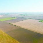
Most of the major corn and soybean states are in a moisture surplus at the moment, which provides an extra layer of defense in case of pending drought. However, extremely wet soil can cause planting delays come spring and eventually lead to the development of disease.
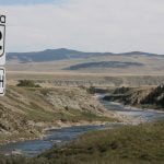
The present dryness in North Dakota is worth watching. The state produces slightly more than half of the U.S. spring and durum wheat but has become increasingly important to corn and soybean production in recent years.
Northern states in particular rely heavily on melting snow in spring to replenish moisture reserves to reduce the chances of drought. For that reason, it is important to receive at least average snowfall and it is common for the snow pack to persist well into April in northern areas.
Snowfall in central and eastern North Dakota is 20 percent below normal this winter, although South Dakota and Minnesota are closer to average levels.
A wait-and-see outlook might not be totally satisfying, but it is likely the most sensible approach. Although additional clarity may not arrive until spring, the odds of a summer drought are surely higher going into this year than they were in the past two years.