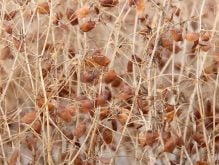
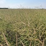
If last year is any indication, measuring the amount of vegetation on cropland is an effective method to estimate spring wheat production in Canada.
Last August, the Crop Condition Assessment Program, a Statistics Canada computer model, estimated that Western Canadian farmers would produce 17.8 million tonnes of spring wheat in 2008.
In actuality, based on data from the Canada Grains Council, 18 million tonnes of spring wheat were grown.
StatsCan continues to refine its computer model, said Frederic Bedard, a remote sensing specialist within the department.
Read Also
Farm groups ask feds for export sales reporting
The Agricultural Producers Association of Saskatchewan and SaskCrops asks the federal government to create an Export Sales Reporting program.
The current model uses data, photos and near-infrared images from a U.S. National Oceanic and Atmospheric Administration satellite to calculate the normalized difference vegetative index for the Canadian Prairies and a region of the U.S., stretching from Montana to Nebraska to Chicago.
“It’s not the amount of vegetation (it measures). It’s a number we calculate. It’s a ratio,” said Bedard.
Near-infrared does not measure heat, Bedard clarified, but the short wavelength light is a useful tool to measure plant growth.
“Vegetation reflects a lot (of near infrared). When we take a picture in near-infrared in a vegetative area, it’s going to be very bright,” he said. “(Plants reflect) very little visible light and a lot of near-infrared light. When you get the two pieces of information together … that’s a unique signature of vegetation.”
Bedard’s team uses that signature to compare the same week over many years.
This year the area southeast of Edmonton to the Saskatchewan border shows less vegetative growth than in previous years.
“We can compare it to 2002. (That) was a very bad year,” he said.
Across the rest of the Prairies, the colours on the map for June 22-28 are a mix of light green, which indicates slightly more vegetative growth, and yellow, for normal growth. There is a large chunk of red or less vegetative growth in the Red River Valley in Manitoba.
“Having it on a map, on a very timely basis every week (during the growing season) … what it does is take a lot of complex data and put it into a very easy to understand format,” said Jeffrey Smith, assistant director of the agriculture division at Statistics Canada.
“Whether the crop is behind because it’s too wet or too cold or too dry or whatever, it’s giving you a snapshot of where things are – on course or behind or ahead.”
Pixels on the map represent a ground area of one square kilometre. But Bedard is incorporating images and data from another satellite, which can narrow the scope to 250 metres by 250 metres.
It will help calculate more accurate yield estimates for spring wheat production, which the computer model generates in August.
Bedard said estimates are based on the historical data for the vegetative index and crop production figures. For example, if the vegetative index this year looks similar to 1995, then the model will make its calculations based on crop yields from that year.
For now the estimates are limited to spring wheat, but Bedard said he is working on a model to generate numbers for canola and barley.
The maps are updated weekly at www26.statcan.ca/ccap.