DAUPHIN, Man. – Luciano Gonzalez likes to play tricks on livestock producers.
“I’ll call a producer and I’ll say, why in the south part of your field (pasture) do you have very low production?” says the animal science professor from the University of Manitoba, even though he’s never been on the producer’s field.
“And on Sept. 30 you were about half way strip grazing the pasture in the north of your field. And they say, ‘wow, how do you know that?’ ”
Read Also
Drones now used to assess wildlife crop damage in Saskatchewan
Wildlife damage in Saskatchewan crops is now assessed by drones and artificial intelligence.
Gonzalez knows such things because he uses satellite images to track what is happening on the ground.
While it remains a novel idea in Canada, livestock producers in other countries already use satellite images to manage their grazing systems.
“The world leader in this technology is Australia,” Gonzalez said.
“They have companies where producers can pay an annual fee and get access to images of their farms.”
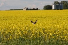
He told producers attending the Manitoba Grazing Tour near Dauphin that the images can provide information on the quantity and variability of forage in a particular field.
Producers who learn that a particular paddock or pasture lacks forage could decrease stocking rates, shorten the length of the grazing period or change forage species on that specific field.
“Its pretty much applying precision agriculture to livestock production,” Gonzalez said.
“We want to develop systems where we can monitor, in real time, different components of the (livestock) production system.”
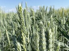
While technology already exists to measure forage quantity using satellites, Gonzalez is leading a project to take it a step further by providing information about forage quality.
He said its feasible to measure crude protein and fibre content from space.
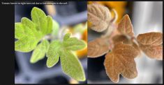
Hyperspectral imaging allows scientists to collect information from across the electromagnetic spectrum, which encompasses more than visible light.
The reflections from a field produce a large amount of spectral data, and satellites are capable of monitoring narrow bands of light.
“For example, they take the reflectance in the band between 400 and 410 nanometres,” Gonzalez said.
“Once they take a picture with those hyperspectral, what we say is we’re going to work only with the spectral bands that are in the near infrared to measure a specific characteristic related to forage quality.”
However, developing a computer model to interpret the wavelengths and measure forage quality is still two years away, Gonzalez said.
In the meantime, he’s teamed up with colleagues at the U of M and the Manitoba government to research other applications for precision livestock management, such as the effectiveness of off-site watering systems.
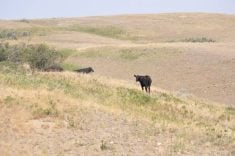
“The questions we’re asking are whether cattle prefer water from off-stream troughs or the stream when given the choice,” said Kim Ominski of the U of M’s animal science department.
The cattle wear GPS collars to track their movement, and satellite images will help the researchers track the cattle’s impact on the stream bank.
Gonzalez said there are many other potential applications for satellite imagery, but cost is a limiting factor.
“Now we are working only with cheap and free satellites,” he said. “The more detail you want, you have to pay for it.”