
The Canadian Prairies have the world’s most stunning sunrises and sunsets.
Match a colourful sky with dynamite scenery and the effect can be even more dazzling. If you’re wandering around southern Saskatchewan this summer, try these five fabulous and easy to reach viewpoints to watch the sun do its magic.
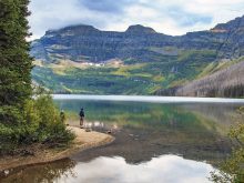
The name comes from the millions of small, round rocks naturally cemented together eons ago. The cliffs face east, on the edge of the escarpment in the West Block of Cypress Hills Interprovincial Park.
Read Also

Fuel rebate rule change will affect taxes and AgriStability
The federal government recently announced updates to the fuel rebates that farmers have been receiving since 2019-20.
In mid-summer, the rising sun clears the horizon on the plains below, shining up at the cliffs and flooding the rocks with an intense crimson glow. The scene is framed by mixed woods forest, Adams Lake below, and green grasslands in the distance.
The main approach to the West Block is southwest of Maple Creek on Highway 271. Signs along the main road through the park point the way to the Conglomerate Cliffs.
This place will have you seeing red as well. The most easily accessible landmark of the Big Muddy Badlands, 60-metre high Castle Butte sits by itself on the wide valley floor.
Impressive at any time, the muddy-looking formation changes its character with the low sun. While sunset is attractive, sunrise is even better, especially in summer when the sun comes up over the lowest part of the valley and strikes the monolith, suddenly bathing it in an almost flaming red. For a different perspective, take the road up the valley slope just west of the butte and look at the rising sun back-lighting the butte and surrounding hills.
[ngg_images source=”galleries” container_ids=”40″ display_type=”photocrati-nextgen_pro_masonry” size=”180″ padding=”10″ ngg_triggers_display=”always” captions_enabled=”0″ captions_display_sharing=”1″ captions_display_title=”1″ captions_display_description=”1″ captions_animation=”slideup” order_by=”imagedate” order_direction=”DESC” returns=”included” maximum_entity_count=”500″]To get to Castle Butte, head south of Bengough on Highway 34, and follow the signs into the valley.
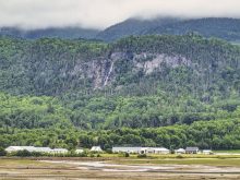
These are Canada’s second largest sand dunes; only the Athabasca Sand Dunes of Saskatchewan’s far north are bigger.
But unlike remote northern dunes, these are easy to visit; simply drive right up to them.
Sand can be a non-descript neutral colour during the day, but springs to life around sunrise and sunset. Pick one of many viewpoints that emphasize the sand’s golden glow. To photograph the dunes, side-lighting with a low sun accentuates the ripples and textures.
To reach the sand hills, head to the village of Sceptre on Highway 32 (be sure to stop at the Great Sand Hills Museum), then follow the signs south.
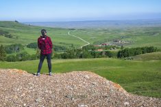
Located straight south of Val Marie, the name dates to the days of early mounted police patrols, since it was 70 miles both east and west to neighbouring posts.
The highest point of land in the region, it also marks the western edge of Grassland National Park. Any time we spend the night in or near Val Marie, this is our go-to sunset spot. The butte faces west, and often takes on warm shades as the sun goes down.
A road leads to the butte, but a better viewpoint for sunset is along the high road to the Two Trees hiking trail. Take Highway 4 south of Val Marie. Where it curves west, continue south on the grid road and then follow the signs. The best view is just past the trailhead.
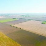
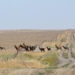
The valley rim viewpoint over the badlands of Grasslands National Park is undoubtedly among the prairie’s most magnificent sights, and one of our favourite places in the south.
We face north over the valley, plus have uninterrupted views east and west, making sunrise and sunset equally rewarding.
In each case, strong side-lighting emphasizes the contours of buttes and wildly eroded hillside formations. Located in the East Block of the park, the viewpoint is a only a short drive from Rock Creek Campground, making it convenient to visit as well.
Arlene and Robin Karpan are well-travelled writers based in Saskatoon. Contact: travel@producer.com.