
The north shore of Lake Superior ranks among Canada’s great road trips. The 700-kilometre stretch of the Trans-Canada Highway between Thunder Bay and Sault Ste. Marie passes through splendid Canadian Shield landscapes lining the world’s largest fresh-water lake.
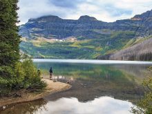
A scenic gem about halfway along this route is Pukaskwa National Park, preserving 135 kilometres of rugged coastline with a combination of ancient granite bedrock, mixed forest, golden sand beaches and stunning views. What appeals to us most about the park is that it offers outstanding wilderness while being easy to access — just a 15-kilometre drive off the Trans-Canada Highway.
To impress the locals when you arrive, learn how to say Pukaskwa correctly, something that first-time visitors seldom get right. Despite what its spelling might suggest, it’s pronounced “Puk-a-saw”. The exact origin and meaning of the word have been lost in time. Thought to have Ojibway origins, one interpretation is that it referred to cooking animal bone marrow.
After arriving at the Hattie Cove campground and day-use area at the end of the road, you may as well put your car keys away for the rest of the stay — the only way to get around is either by walking or paddling. The park is famous for the Coastal Paddling Route, providing great opportunities for canoeing or kayaking, while the 60-km Coastal Hiking Trail ranks among Canada’s premier backpacking routes.
The good news is that you don’t have to tackle multi-day wilderness expeditions to enjoy the park. A wealth of amazing landscapes are a short walk from Hattie Cove. It almost seemed like we were walking through a Group of Seven painting. Places like this along the Lake Superior shore inspired the famous artists to create some of their most enduring images.
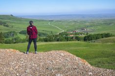
Our favourite short hike is the 2.2-km Southern Headland Trail. Starting next to the visitor centre, it climbs the rocky hills where Parks Canada’s iconic red chairs overlook Hattie Cove. It then winds along the top of the headlands where we can appreciate the vastness of Lake Superior, eventually ending at an attractive sandy beach in Horseshoe Bay near the campground.
Interpretive panels provide the lowdown on everything from geology to history and wildlife. One display describes Lake Superior as the world’s largest air conditioner, since the immense volume of water acts like a refrigerator on a warm summer day. We feel that effect often as we experience short-sleeve shirt weather along forest paths away from the lake and then have to don sweaters as soon as we reach the shoreline.
Other short trails take us over rocky ravines to cliff tops with gorgeous views, and along a series of beaches scattered with driftwood. Since most trails are interconnected, there’s the option of doing one at a time or linking a few together for a half-day excursion.
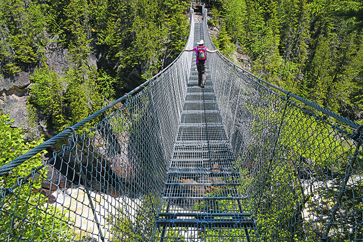
The top day hike, however, is to the White River Suspension Bridge and Chigamiwinigum Falls, along the first part of the Coastal Hiking Trail. The 18-km return route weaves through forest and beside the lakeshore.
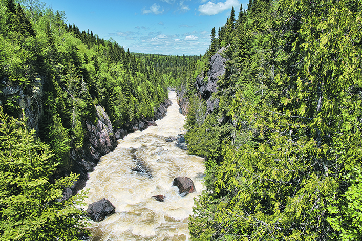
The silence of our forest walk is interrupted by the crashing sound of water plunging down the narrow chasm. We emerge from the trees, step onto the edge of the bridge, and cautiously glance down 23 metres to frothing Chigamiwinigum Falls. It’s disconcerting looking through the open steel mesh floor of the 30-metre-long bridge as we slowly work our way across and peer straight down into the churning water far below. As far as we can see in both directions, the White River roars and cascades down the deep gorge as it races towards Lake Superior.
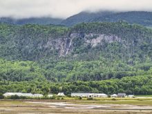
Hattie Cove Campground is the only place to stay in the park. An excellent option for those without camping gear is to stay in an oTENTik, a cross between a frame tent and a small cabin. The nearby town of Marathon also has a variety of accommodations.
Arlene and Robin Karpan are well-travelled writers based in Saskatoon. Contact: travel@producer.com.