Western Canadian agriculture will benefit from NASA’s new eye in the sky, says a University of Manitoba professor.
Launched in California at the end of January, the U.S. government agency’s soil moisture active passive (SMAP) research satellite is the result of an international effort to improve soil moisture monitoring.
Officials say the high resolution images collected from the satellite should assist researchers and policy-makers around the globe and improve drought and flood forecasting and crop yield and quality projections.
“We don’t monitor soil moisture the same way that we do with weather stations and precipitation,” said Paul Bullock, a professor in the U of M’s soil science department.
Read Also
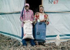
B.C. ostriches culled, CFIA confirms
Ostriches on an embattled Edgewood, B.C. farm have been culled after a prolonged legal battle, the Canadian Food Inspection Agency has confirmed.
“We just can’t get sensors all over Western Canada to be able to monitor the whole Prairies that way. That’s where the satellite is useful. It gives you a frequent update that’s continuous across the whole region.”
The satellite images will provide soil moisture information to a depth of five centimetres over several kilometres, said Bullock, who contributed to SMAP tests conducted in the Portage La Prairie-Carman region in 2012.
The information isn’t detailed enough to help producers who are concerned with the root zone in individual fields, but it could serve as a risk assessment tool, helping identify regional disease or pest concerns.
“This is providing kind of a risk assessment tool that they can use to make decisions,” said Bullock.
“Agronomic companies can use it more directly to try to determine where they best want to have their product available.”
The SMAP information will be in the public domain, and NASA plans to start releasing it later this year.
However, Bullock said it must be combined with other data to be of greatest value. For example, factors such as crop cover must be considered when interpreting the satellite data.
“My guess is that the products that you can develop with it are going to be rolled out, for example, by companies or agencies that might have weather data that they can then use the weather data to put with the satellite data and build up this picture,” he said.
Contact dan.yates@producer.com