THAMESVILLE, Ont. — Field crop management is expected to be much easier in southwestern Ontario with the launch of the AGGrower Daily Dashboard program, according to the agronomist leading the project.
It uses an advanced system to collect and analyze weather data so that enrolled farmers can respond quickly and efficiently to what Mother Nature throws their way, said Dale Cowan, senior agronomist with Agris Co-operative, Wanstead Co-operative and Haggerty Creek Ltd.
He said today’s agricultural environment means there’s usually more than one farm to be managed. In fact, fields are often kilometres apart.
Read Also
China’s grain imports have slumped big-time
China purchased just over 20 million tonnes of wheat, corn, barley and sorghum last year, that is well below the 60 million tonnes purchased in 2021-22.
As a result, a farmer can rarely walk out his back door to judge how inputs and operations should be managed.
“Some of the guys have 100 fields spread from Windsor to Sarnia. I’d say most of them have 20 or 25 fields to manage,” Cowan said.
The program can be assessed from a smartphone or through a website.
Eighty automated weather stations are being installed in a five-county area this year that will measure temperature, precipitation, wind speed and humidity. As well, weather data will be collected through 500 public and volunteer sources.
The $200 sign-up fee is being waived for 2016. Interested farmers within the service area, regardless of whom they do business with, can sign up.
Cowan said the system helps bridge the gap between weather events and management decisions.
“Anyone can track the weather,” he said.
“It’s what you do about it that’s important.”
The program include recommendations for herbicide, pesticide, fungicide and fertilizer applications, growth stage modelling, dry down forecasts, frost warnings and an alert system that encourages farmers to act.
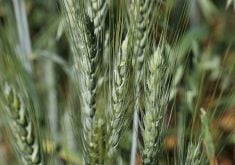
For example, farmers were advised in the third week of May that the development of fusarium head blight in wheat was likely, Cowan said.
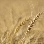
The program’s modelling feature also predicts the growth stage of corn, which is important because weeds are controlled at the V-4 or six-leaf stage to maintain yield potential
As well, models predict when corn is likely to achieve black layer and how quickly moisture levels are likely to fall.
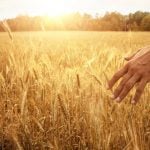
The program also uses unmanned aerial drones with multi-specification and thermal imaging capability to collect crop information.
This allows farmers to determine, through real-time nitrogen tests, how much additional nitrogen is likely to be needed to maximize their yields or if nitrogen is needed at all.
Farmers can sign up fields of corn, soybeans, wheat and processing tomatoes, but additional crops may be added in the future. They need to enter the appropriate data for their fields, starting with the planting date.
The program then delivers the type of information farmers need to make the most of their farming investment, Cowan said.
The AGGrower website is hosted by Ontario-based Weather INnovations, which specializes in weather data and agricultural modeling. It is supported by close to $600,000 from the federal-provincial Growing Forward II program.