Conserving the South Sask. basin | Landowners can continue to manage their own property
A draft land use plan for southern Alberta includes proposals for more conservation areas, parks and protection of biodiversity in the province’s most heavily populated region.
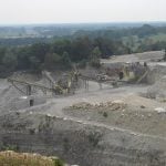
The 150 page South Saskatchewan Regional Plan draft, which covers the South Saskatchewan River basin, was released Oct. 10 in Calgary.
“Every day we see growth pressures in this part of the province,” said provincial environment and sustainable resource development minister Diana McQueen.
The project, which has been underway since 2010, returns to the public for consultation from Nov. 5-28 in 21 communities. Input will be accepted until Jan. 15 and any adjustments that are required will be done by spring. The plan becomes law once provincial approval has been received.
Read Also

Gene editing digs deeper space in Canadian plant breeding
More Canadian research into crop variety development is incorporating gene editing, and one researcher notes that Canada’s regulatory approach to gene editing will help drive innovation
The government has acknowledged the plan will not please everyone.
“Remember this is a draft document,” McQueen said.
“We want to hear what you think about the draft regional plan for southern Alberta and provide us with direction.”
The plan offers seven outcomes to protect the headwaters, grasslands, agriculture, air and water quality, as well as fragile regions such as the eastern slopes of the Rocky Mountains.
Agriculture and intact native grasslands are recognized as important land uses.
Few changes are proposed for native grasslands because the government felt landowners have voluntarily done considerable conservation work.
“We took a look at some of the measures in place today and they seem to be working,” said stewardship commissioner Bev Yee.
More voluntary conservation agreements or protected areas could come later.
Freehold mineral holders and private landowners can continue to manage their property and resources.
Many areas were already protected by policy, but protection will be law once the plan is accepted, said Scott Milligan of the sustainable resource development department.
One area up for dispute is the Castle Mountain region in the southwest. Under the plan, 109,000 acres in the Castle area will be designated as a wild land park and another 25,000 acres will continue as a conservation area.
A wild land park is the highest protected designation in the province, similar to a national park.
Existing tenures for oil, gas and timber will be honoured, but McQueen said there is a hold on further leases in the eastern slopes until the plan is enacted.
Municipalities are encouraged to work with the province to designate land for development and discourage fragmentation of agricultural land.
Another 1,000 camping spaces from minimum impact to fully serviced sites will be created, and designated trails will be created for off-road vehicles.
There is also a commitment to watershed protection, and timber companies’ future plans must be in line with headwaters protection.
The plan also considered climatic disasters. A provincial task force is working on mitigation efforts for future floods that still fit with plan objectives.
McQueen said the basin will not grant more water licences because the resource is fully allocated. She said plans must be made for future development to ensure there is enough for the growing population.
The document can be viewed at landuse.alberta.ca/RegionalPlans/SouthSaskatchewanRegion/Pages/default.aspx.