Potholes have been a major water issue since farmers first arrived on the Prairies in the mid-1800s.
Draining potholes was inevitable if the Prairies were to become productive and support a growing population. Seventy percent of potholes have since disappeared, according to the 2008 Canadian Wetland Inventory.
Satellite imagery shows that the remaining prairie wetlands cover about 234 million acres, one-quarter of all the world’s remaining wetlands.
Environmentalists, along with the mainstream public, are now putting more pressure on politicians to preserve these wetlands.
Read Also

Solar, sheep provide valuable farm diversification
Eric Steeves says raising sheep on forages grown under solar panels provided economic stability and perhaps even saved his family’s fifth generation southern Alberta grain farm.
However, there is a compromise between drainage and pure pothole preservation – low-level water retention dams that would hold water until mid-summer.
Farmers developed it during the Dirty Thirties, in conjunction with new government agencies such as the Prairie Farm Rehabilitation Administration and conservation groups such as Ducks Unlimited.
Today, the plan may be key to satisfying farmers and the public in the debate over how to manage remaining wetland acres.
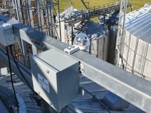
Low-level water retention dams are inexpensive control structures that hold water during spring and early summer.
Water recharges local water tables and provides moisture for early summer showers.
Ground water recharge becomes much more important when remembering that more water exists underground than on the surface. Pothole drainage removes surface water in the spring before it can infiltrate the soil.
Drainage also affects rainfall for crop growth. According to Canada Water Facts, once a single molecule of water evaporates from a pond, it typically remains in the air for 10 days before returning to the soil in the form of rain.
Maintaining prairie potholes ensures evaporation and a better supply of air-borne moisture for those necessary showers.
Cleaner water is an often overlooked benefit of wetlands. A natural wetland filters sediments and pollutants before the water flows downstream to the next user. The settling effect removes particles, while vegetation and biological action removes organic, livestock and agriculture chemical pollutants from adjacent fields.
A managed wetland provides water for spraying, livestock, irrigation and high volume forage crops around the pond periphery.
By mid-summer, the remaining water can be released so hay crops can be harvested before freeze up.
Flood prevention is another significant benefit of low-level dams.
Bill Turner of the Deerwood Soil and Water Management Association based in Miami, Man., said a drained pothole is nothing more than a big ditch.
He said water flows out as quickly as it flows in when a drainage ditch is designed and executed properly, which is not necessarily a good thing.
It may serve the short-term goal of drying land for spring seeding, but it can trigger immediate negative effects. Water quickly finds its way down the watershed, where it causes flooding.
On the other hand, upstream water retained in small potholes alleviates downstream flooding by serving as a sponge. When the water is finally released in mid-summer, downstream water bodies can usually accept the extra water without risk of flood.
Sometimes the best engineers are found in nature, as farmers near Miami, Man., discovered when they enlisted beaver intelligence to help solve their water management problems along the South Tobacco Creek.
This is one of the best documented and perhaps best managed watershed projects in Western Canada. Biological, hydrological and agronomic research has continued since the first dams were built in the 1980s.
Turner said the Manitoba government has studied the impact of small dams in preventing nutrient runoff from farm fields.
“From what we’ve seen so far, a very high percentage of the silt people get downstream doesn’t come from farmers’ fields,” he said.
“The dams seem to prevent field runoff from finding its way downstream. It looks like most of the silt people get downstream comes from stream bank erosion.”
The project began after severe flooding in 1979 prompted farmers to work together to figure out how to reduce flooding and soil erosion. The result was the Deerwood Soil and Water Management Association.
Working with hydrological engineers, the association concluded that the beavers’ design of small headwater storage dams might solve their problem more effectively than digging bigger and better drainage ditches.
They studied how beaver dams held water during spring runoff and major rainfalls. The association then built 52 dams on private farmland on South and North Tobacco Creeks and Graham Creek.
Funding came from provincial and municipal governments, Ducks Unlimited and the PFRA, now Agriculture Canada’s agri-environment services branch. Landowners were responsible for dam maintenance on their property.
“We are proving that grassroots conservation is effective,” Deerwood association president Les McEwan said during the dam building period.
“Our soil and water management programs are paying off for farmers, local governments and for the people living further downstream.”
The 350 sq. mile watershed drained by the creek runs down the escarpment from the high rolling hills of western Manitoba to the flat bottom of the Red River Valley.
Engineers recommended three types of dams, depending on a landowner’s position within the watershed.
- Flood control dry dams fill in the spring or in a heavy rainfall and then gradually release water until the reservoir is empty.
- Back-flood dams retain shallow water over a large acreage on cropped land, forage or pasture land for at least two weeks. All water is then released until the field is dry. The water often flows down to another back-flood field.
- Multi-purpose dams are the same as flood control dams, but half the storage capacity is retained for summer water use.
The average cost per dam was $9,774, according to the Deerwood association.
Engineers working with Deerwood estimate the average storage capacity per dam is 21.6 acre feet of water and the overall dam network reduces peak spring melt flow by an average of 19 percent, enough to significantly reduce downstream flooding.
Some dams, such as the one at the Steppler Site, have reduced the peak runoff flow by 90 percent.
Annual maintenance costs for roads, bridges and ditches have also dropped. The two rural municipalities in the watershed report annual savings of $25,000 each since the dams were built.
In 1995, the International Coalition for Land and Stewardship in the Red River Basin analyzed the economics of the small dam network on South Tobacco Creek.
It concluded that a proposed single large dam on South Tobacco Creek would have cost three times as much as the 26 small dams. The big dam would not have provided a better level of flood protection downstream in the drainage basin, nor would it have done anything to reduce erosion and improve water quality upstream, where the farmers are located.
The 3:1 cost ratio comparison of a single large dam versus a network of small dams is similar to what the U.S. Army Corps of Engineers discovered after studying the impact of the 1993 flood in the Mississippi watershed.
It concluded that the higher upstream in a watershed the dams are built, the smaller and cheaper they become. Many small dams are more effective and provide more local benefits than a few big dams.
Studies following the 1993 flood also found that one small upstream retention dam might serve an immediate watershed ranging from 20 to 2,000 acres, while a single big dam may be required to contain the water from millions of acres.
It’s not a major disaster if one or two of these smaller dams break or overflow because of too much water. Many more similar dams hold water upstream in the basin, each holding a noncrucial volume.
However, if all that water were to flow downstream into the lower basin, the runoff from millions of acres must be controlled with a small number of big dams rather than a big number of small dams.
In a year like 1993, when the entire watershed received above normal rainfall for an extended period of time, the system of dikes and levies could not handle the volume.
“We’ve toured a number of other conservation districts and we’ve heard from other parts of the Prairies,” Turner said.
“People are still using our basic model when they build low-level retention dams. And they’re building more of these dams every year.”