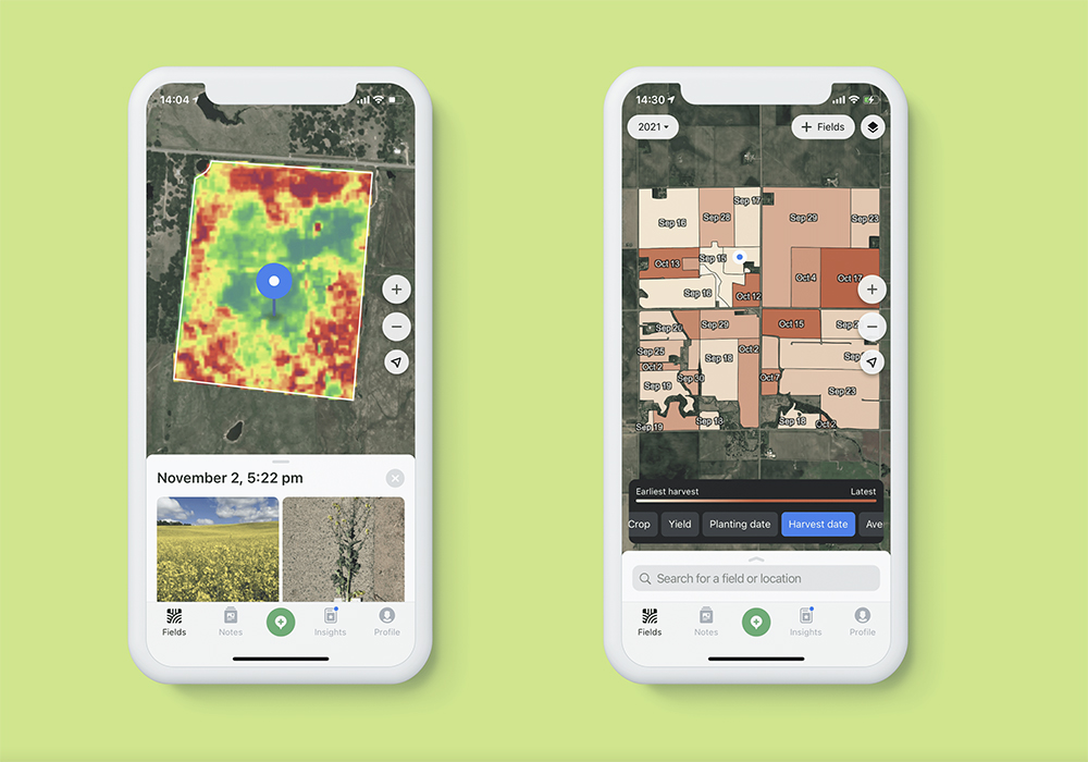
In its quest to provide free high-quality images to the world’s precision agriculture farmers, OneSoil did not overlook the Canadian Prairies. It recently hired a field staff member to cover Western Canada.
Kyle Hoyda, who spent his childhood raising cattle and growing grain north of Edmonton, has worked in Canada, Australia and the United States for the last decade demonstrating how to incorporate technology into farm operations. He spent the last seven years with Farmers Edge and is now stationed in Calgary working for OneSoil.
“A lot of farmers haven’t moved into precision ag yet because they’re intimidated by the process of getting started. It can be a very stressful experience,” said Hoyda.
Read Also
Defence investments could benefit agriculture
A bump in Canada’s NATO spending commitments could lead to infrastructure investments that would benefit rural areas
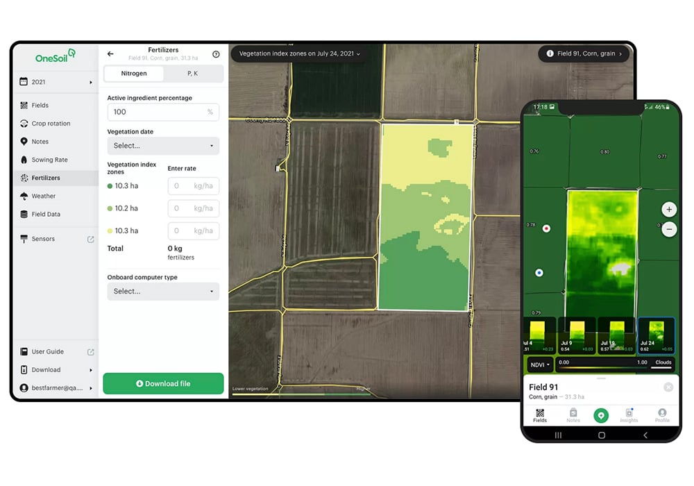
“OneSoil brings a lot of technology in a simple package. We offer farmers the chance to sign up and have satellite imagery of their farm in their hands in a matter of minutes. Canadian farmers will find that it’s easier to use our tools compared to any other system in the marketplace. We completely bypass all the multiple steps found in other systems.”
He has demonstrated to producers how they get their screen loaded up and ready to go in a matter of minutes, compared to some systems that take days of a farmer’s time.
“Once you’re logged in, you select your field, then draw field boundaries the way you want them and upload shape files. But the feature I like and that growers really seem to appreciate is Automatic Field Boundaries. You can start clicking on your fields right away and get your images within 30 seconds.
“Within five minutes, start to finish, OneSoil gives you the ability to scout a field, drop in photos, make notes, whatever you want to do. It is the quickest tool on the market. We typically get one image per week, but that depends on cloud cover. If we received an image yesterday, then it’s already processed and in the system for you today.
“We replace all other precision ag platforms. Some guys use one platform for satellite imagery, another platform for variable rate, maybe someone else for yield processing. We can do all that in-house for the client.”


