A cold front has moved into southern Saskatchewan from northern Montana, bringing much need rain to parched Prairie soils.
Much of Saskatchewan is under an extreme fire risk warning because of dry conditions, but now south western and south central Saskatchewan has been placed under a heavy rainfall warning by Environment Canada and is expected to receive 50 to 80 millimeters of rain over the next 48 hours.
Read Also
Saskatchewan tests new forage insurance program
Saskatchewan Crop Insurance Corp. tested a new forage insurance program this past summer as it looks for ways to better protect cattle producers.
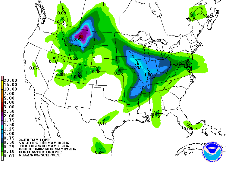
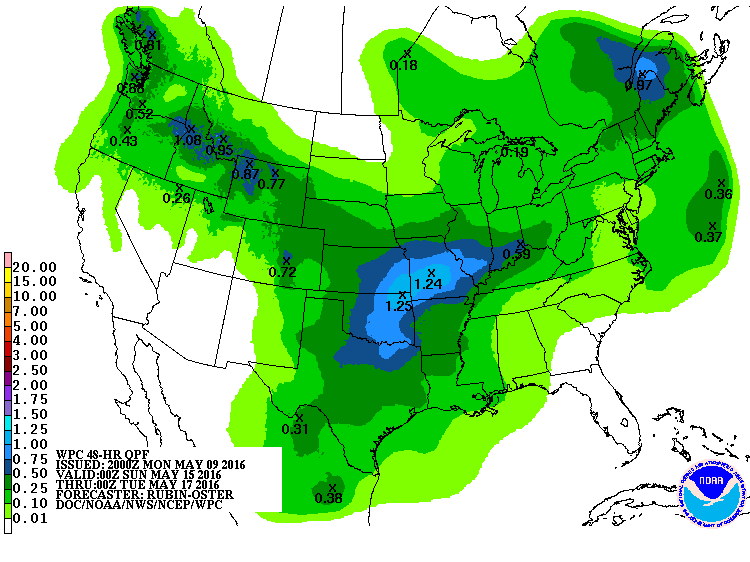
This map from the U.S. National Weather Service Weather Prediction Center (WPC) was issued at 12 p.m. Monday, and it shows precipitation forecast for 6 p.m. May 10 to 6 p.m. May 11. The heaviest rains will occur in south western Saskatchewan, however much of the Saskatchewan and Manitoba grain belt is set to receive precipitation.
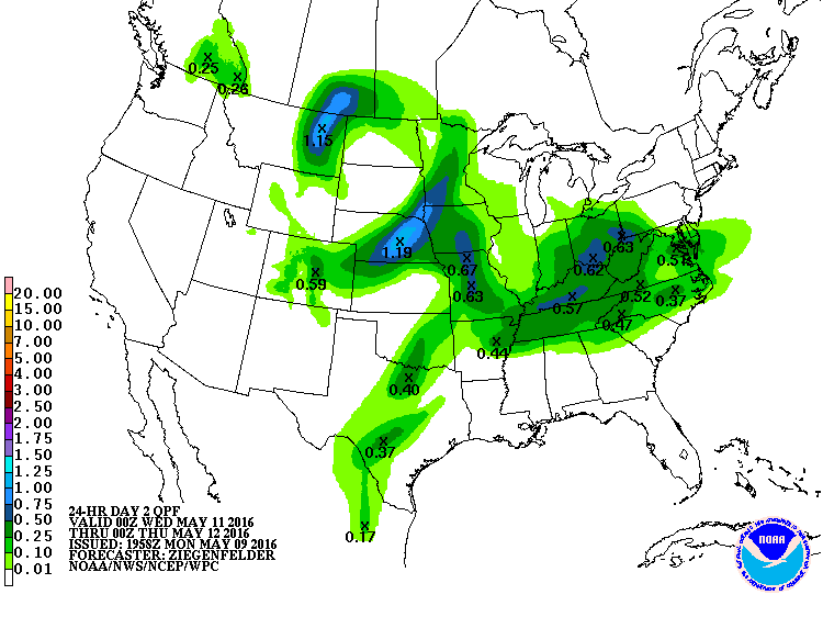
The following map was issued 1:30 p.m. Monday, and it shows the precipitation forecast for 6 p.m. Wednesday May 11 to 6 p.m. Thursday. It shows the rain system holding position over south central Saskatchewan.
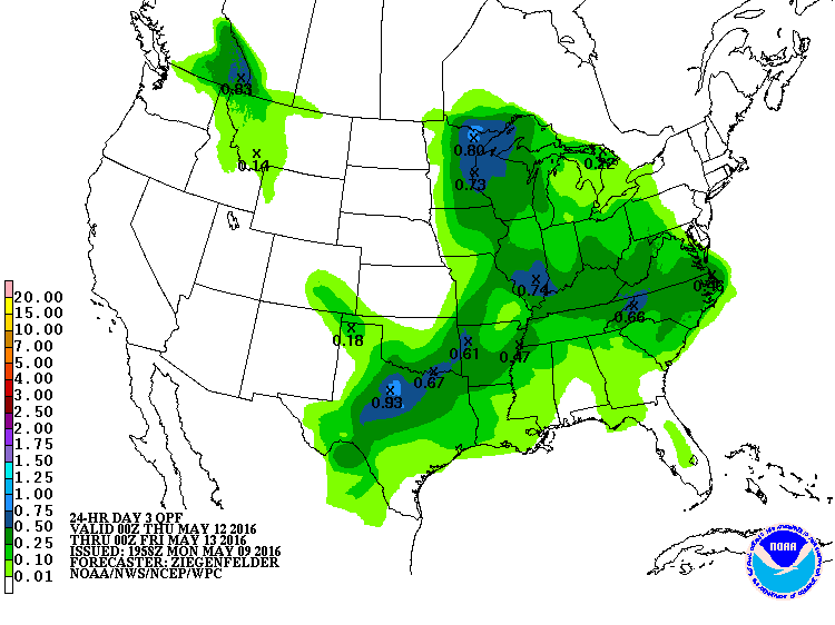
By Thursday afternoon the rain system will likely have moved out of south eastern Manitoba and away from Prairie growing regions. This map was issued Monday afternoon and is for 6 p.m. Thursday to 6 p.m. Friday.
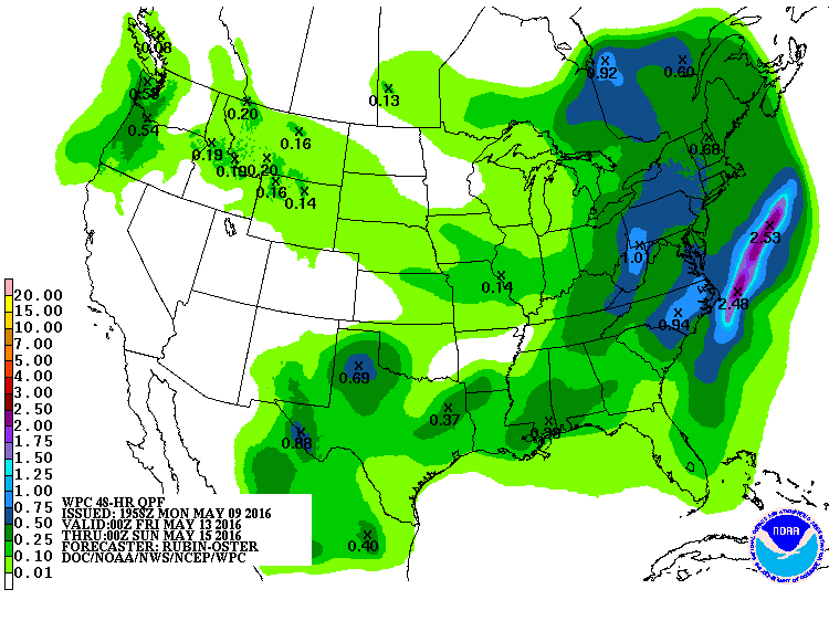
This precipitation map for 6 p.m. Thursday to 6 p.m. Sunday shows much of Manitoba could receive light precipitation during this time.
The following map, which is for 6 p.m. Sunday to 6 p.m. Tuesday, shows little chance of rain on the Prairies.
The following graphic is a collection the above maps.

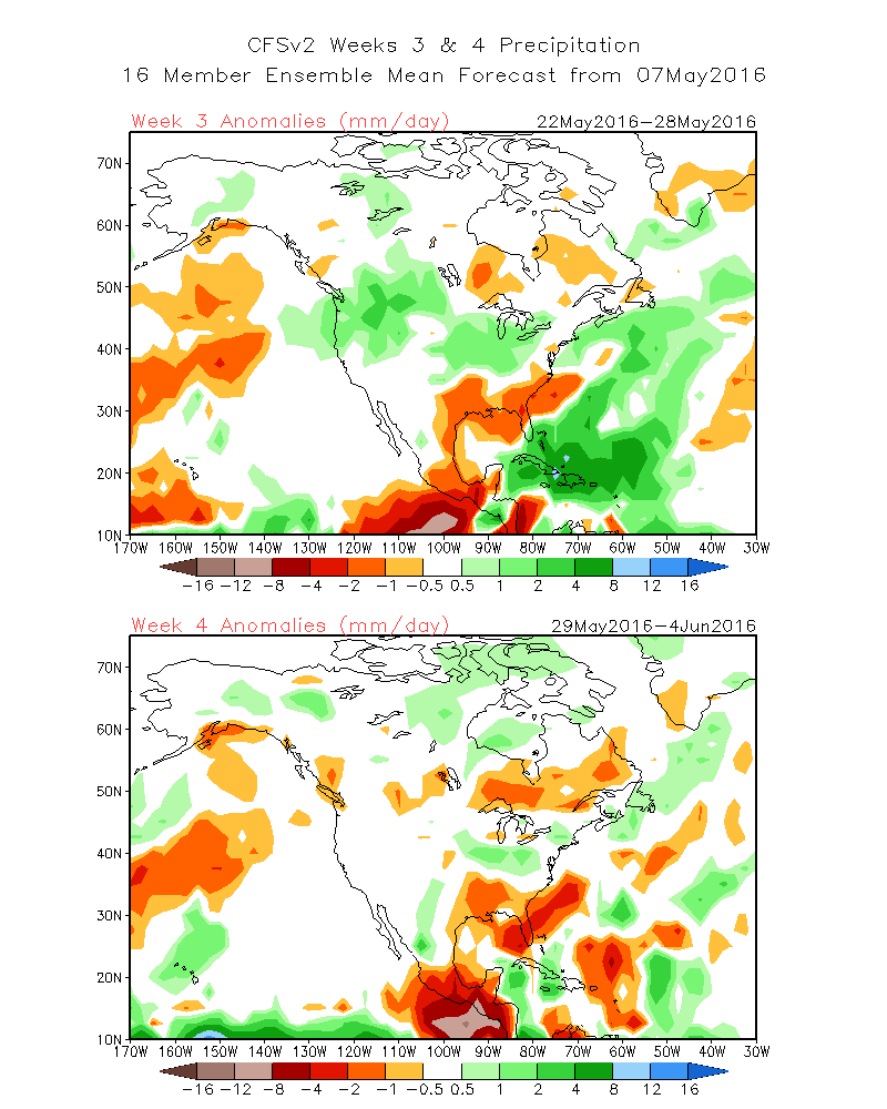
The following map from the U.S. Environmental Modeling Center at NCEP, show the precipitation prediction for May 22 to May 28, and then May 29 to June 4.
In the May 22 to May 28 map it looks like the southern Prairies could receive some rain.