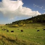
NISKU, Alta. – The old crop scouting adage about “no substitute for walking your fields” may have been true last year, but technology has a way of making old sayings obsolete.
If your farm is too large to walk two or three times a summer, consider the possibilities of an agricultural drone aircraft. It is small and remote controlled, powered by a revolutionary electric motor and equipped with a digital camera, a transmitter for the photos and infrared stabilizers to keep the aircraft level for accurate aerial photography.
Read Also

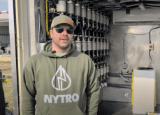
VIDEO: Green Lightning and Nytro Ag win sustainability innovation award
Nytro Ag Corp and Green Lightning recieved an innovation award at Ag in Motion 2025 for the Green Lightning Nitrogen Machine, which converts atmospheric nitrogen into a plant-usable form.
With a transmitter mounted in the plane, producers can save the photos to their computers live in real time as the aircraft flies over each target. To save a few dollars, they can skip the transmitter and download the photos to their computer after the plane lands. If they want the GPS option, they can geo-reference photos to their existing field maps.
It all sounds like top-secret U.S. military drone technology, but it’s available to prairie farmers now and it’s affordable.
“There have been tremendous advances in the hobbyist type of remote controls,” said Olds College professor Gord Gilchrist. A helicopter engineer by trade, he is part of a team of researchers at Olds that has been exploring the potential of putting hobbyist-type remote control aircraft to work on the farm.
“The biggest breakthrough in remote controls are electric motors instead of the conventional two-cycle or four-cycle gasoline engines,” he said during a recent Direct Seeding workshop in Nisku.
“Along with that we have speed controllers and new batteries that are lightweight, yet have enough power to reliably propel an aircraft for (45) minutes or longer.”
Gilchrist said most people have observed or even operated the old two-cycle hobby planes. They were loud and the buzzing little engine shook the plane. The four-cycle hobby engines that came to the market a few years ago were quieter and smoother, but both engines created too much vibration for aerial photography. People were understandably reluctant to install an expensive camera because when the planes ran out of gas they often came down in a big hurry.
A few years ago, hobbyists became aware of small, industrial electric motors produced in Germany and Czechoslovakia.
The miniature electric motors are capable of matching the performance of conventional gasoline engines, and their output can easily be controlled by an operator on the ground. The motors are brushless and operate on three-phase power supplied by a new generation of rechargeable batteries.
“Battery advancement was essential to making this whole thing happen,” Gilchrist said.
“We have gone from the old, rechargeable nicad battery to a new lithium polymer battery that packs four times as much energy for the same weight, and weight is the key in any kind of aircraft.”
The airframe can be fitted with any type of digital camera, Gilchrist said, so that part of the investment can range from $200 to more than $1,000 if a person wants to be extravagant. However, because most people already have digital cameras, this cost can also be zero.
For comparison purposes, the test plane in 2005 had three openings in the belly of the fuselage and usually carried three cameras at a time. The researchers tried four megapixel, six megapixel and wireless video cameras.
Gilchrist said the remote control unit is straight off the shelf of any hobby shop, so it includes an extra circuit that he used to trigger the cameras. A remote control finger mounted on the camera lets the operator trigger the camera whenever he wants a shot.
If the images are live, the operator has a better opportunity to get the exact aerial shot he wants. Without a live broadcast, the operator has to visually track the location of the airplane and trigger the camera when he thinks it’s over a target spot.
One problem with a belly-mounted aerial camera is that the picture is skewed when the aircraft tilts in any combination of fore-aft or left-right. An accurate image requires the camera to be perpendicular to the target on the field surface.
To obtain this correct geometric relationship with Earth, the experimental ag drone aircraft uses four infrared sensors. One sensor looks forward while a related sensor looks backward. Another sensor looks left while the related one looks right. Each of the four sensors takes continuous readings.
“If the aircraft nose points slightly down, even a little bit, the front-facing infrared sensor reads a warm signature from the Earth and the rear-facing sensor reads a cold signature from the atmosphere,” Gilchrist said.
The computer that processes the infrared data and passes it on to the flight controller is about the size of a book of matches. Gilchrist said the computer deals with the information on-board more quickly and with greater accuracy than an operator on the ground working through a laptop and hand-held remote control.
The usefulness of ag drone aerial images will depend on how well equipped a producer is on the ground.
“With some digital cameras, the basic software that comes with the camera is all you need. The common Photoshop software also handles the information very well.”
Beyond that, a person can take it as far as he wants. Gilchrist said that if a farmer is already set up with field maps and is using them, the photos can be a great tuning tool.
“You can geo-reference the photos with real world co-ordinates. Then you can take a basic, cheap hand-held GPS unit and navigate your airplane to the precise spot on your farm you want to investigate. The system to run GPS will cost anywhere from $300 to $1,000 depending on how fancy you want to get.”
Even if a field mapping system is not in place, the photos can provide useful information.
If there’s a need to scout a certain area or a question about a specific piece of ground, the photos can be taken immediately and over the exact spot. A grower can take photos monthly, weekly or daily if there’s a reason.
The on-board equipment is built to take abuse, but there’s only so much it can withstand. With a couple thousand dollars worth of equipment wired to the plane, Gilchrist said all operators should be well trained.
He suggested the best way to start is with flight simulator software on a computer. Once a person has mastered that, the next step is the learner drone.
“I recommend two separate aircraft,” he said. “The airframe is only $200. It’s the cheapest part of the whole operation, so it makes sense to build a learner airplane first. Once you’re competent at that, then go ahead and build your serious airplane with all the gadgets.”
The planes weigh three kilograms when fully loaded and have a wing span of approximately two metres, which Gilchrist said results in a good ratio of weight to wing area.
“It comes in for landing at 16 km-h, so you can get a nice gentle landing just about anywhere.”
Gilchrist said the airframe should cost about $200, the motor $150 and the speed controller $100. The lithium polymer batteries are $80 each and he runs two of them to have a backup.
“You don’t really need GPS, but if you want to geo-reference everything, the entry level cost is $300. Costs on the digital camera and computer software all depend on what you already have available to you and how far you want to take it. I would think that for a complete outfit, including infrared stabilizer and remote control unit, a person would spend about $2,500.”
For producers thinking about how to get the next generation interested in a future in farming, the remote control ag drone spy plane might be just the thing.
There are obviously many things that can be seen on the ground that can’t be detected from the air and likewise many things that can be seen from the air that wouldn’t be noticed walking the fields. As for the old saying about walking your fields: the practice will never become obsolete. However, affordable homemade aerial photos may help guide those walks.