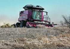
To navigate around the sloughs, bush and other obstacles on his farm near Stony Plain, Alta., Johannes Heupel has developed his own GPS mapping program that runs on a laptop computer. It’s called FarmerGPS.
“When GPS started, the first time I looked at it was four or five years ago. With the LED light bars, I tried them in a parking lot at a demo and while I thought it had a lot of promise, I felt the light bar, due to the sloughs and bush areas I have, basically it’s no good. I would very quickly get lost without any visual indication of where I am in the field,” said Heupel, who farms 3,500 acres with his father.
Read Also

VIDEO: Green Lightning and Nytro Ag win sustainability innovation award
Nytro Ag Corp and Green Lightning recieved an innovation award at Ag in Motion 2025 for the Green Lightning Nitrogen Machine, which converts atmospheric nitrogen into a plant-usable form.
“The light bar would tell me to go left or go right, and I would have no clue why. While I thought it was basically a good idea, I felt it was unusable for me.”
He said he also experienced typical problems when spraying with foam markers.
“I had herbicides that were pretty aggressive, and going around sloughs twice, then trying to figure out which triangles were left that I didn’t spray, was a major headache. I’d get out of the tractor and look at all the foam, but I couldn’t make any sense of it.”
Heupel grew up on a farm in Germany and worked as an electrical engineer and software programmer before immigrating to Canada. He still has an off-farm job as a computer programmer to supplement his farm income.
“I have both sides of it. I looked at the specs of GPS and how it works. You find out that all (GPS systems), with maybe one or two exceptions, provide latitude and longitude in a standard format – NMEA,” he said.
“After you have that and you know they use the serial port, which is a simple port from a programmer’s point of view, the rest of it is a lot of math and some decent drawing routines to show where you are and where you have been.”
Heupel’s concept was to show, on a colour laptop screen using half tones, a bird’s-eye view of where the producer is, and where his equipment has been.
“I draw it with the equipment width size on the screen. Overlaps would be a stronger colour – two half-tones make it darker. If you drive over it again it makes it stronger yet,” he said.
“Where you miss will be the background colour, which is white, so you see where you miss and where you’ve been. And I combine that with a navigation bar or light bar simulation, which tells you to go left or go right, very much like a light bar.
“You have both things on the screen. What my biggest problem with the light bar was, I don’t know where I am. It’s OK to tell me to go left or right for the moment, but I don’t know if I have to turn around to catch that triangle I missed.”
This goal provided the mapping system’s core function. Over time, with customer requests, Heupel has added options.
“You can mark points where you have rocks or weed patches. I keep records automatically, so I can go back and see which field I sprayed at what time, duration and average speed. All these things are easy to get once you have the data,” he said.
“This year, I also have straight A-B line guidance, which you will find on a lot of other products. If you really want the straight line down your field, like for seeding, that option is there. For some fields it’s valid, but for most of my fields, it’s hard to divide it where it makes sense.”
Heupel’s latest program has an automatic function available for farmers who go around the outside of the field first. The function will automatically factor that in.
Heupel said other GPS units have a second serial port where farmers can plug in their laptop.
“You configure the Outback, Trimble, Accutrack or what have you to output RMC NGJ and all of them allow them. That’s all FarmerGPS needs to draw your maps.”
Heupel started working on his program in 2003.
“In the first year, I had an application that was only usable by me. It was a complete prototype,” he said.
“I threw that out after the first season, but I had all my concepts worked out. I worked over the winter to get the next version out – for my operation and my dad, who’s past 60 and who doesn’t like computers. So I tried to make it simple.”
A couple of neighbours liked what they saw and wanted to try it out, so Heupel produced a few more prototypes. By 2006, he had two dozen customers.
Heupel said many commercial GPS systems have only small screens for mapping. By using their laptops, producers get a 12-inch screen.
However, there are other reasons for using a laptop.
“On 3,500 acres, I’m using the GPS for two or maybe three months out of the year. The rest, that proprietary equipment would sit and not do much,” he said.
“With GPS the way it has been, two years down the road that equipment is obsolete. With the laptop, I get 12 months of use out of the year, because I use it for other stuff on the farm. The laptop will also be obsolete after three years, but at least I’ve had good use out of it.”
Heupel set up his own mounting systems to use in his tractor and sprayer, but he said commercial mounts are available.
“People use them in pick-up trucks, police cars or in other industries, so there are laptop mounts you can buy. What you’re looking for is to put some foam there so you reduce vibration. But don’t cover the back completely, as the heat has to be able to get away from these laptops,” he said.
“The biggest thing for tractor use is make sure you have the space in the cab. Don’t buy a 17-inch screen if you can’t find space for it.”
Durability is a common concern. Dust, vibration and other threats could damage a laptop in a tractor cab.
“I can only say I’ve been using mine for four years now and I’ve had no troubles whatsoever. I use it on business as well, and I think my use in airplanes and boardroom tables is worse than the relatively stationary use in my tractors,” Heupel said.
“I have customers who simply buy a Tuff book on EBay if they’re too concerned. FarmerGPS will run fine on a PIII. I have customers who claim it runs fine on a P166, but I would not claim that. I tested it on a PIII 300, which is a very old machine and it works fine.”
Heupel said farmers can buy a complete package from him, or if they already have a GPS receiver and laptop, they can just buy the software.
“Most newer laptops no longer have the serial port, so I also package a USB-R232 converter. I also ship a little interface box that allows you to integrate your sprayer or seeder controls.”
The interface needs a 12-volt source, which he said farmers can often access right off the switch so that they’ll know if their equipment is on.
“That way, when the laptop draws where you’re going and you turn your equipment off, it knows it and it only draws a single pixel line as the path. When it’s on, it draws with the equipment width,” he said.
“Some customers say it’s not important; they know on the headlands it shows double coverage there. It is an option and I have some customers take it and some don’t. But it will make your acre counts correct. Before, you’d get acre counts way too high.”
The software costs $349, while the full package, including a GPS receiver, costs $1,299.
The mapping system was designed for seeding and spraying, but Heupel’s customers have found other ways to use it in their operations.
“You can now output operation files to KML (Google file format) like Google Earth files, then overlay your field files to satellite imagery from Google Earth. I have a couple of customers who do custom spraying and need to show to their customers where they have been,” he said.
“The field map itself doesn’t really show that in relation to anything. However, if you overlay it to a satellite map, that makes a lot of sense for their customers.”
Heupel also uses his FarmerGPS while cultivating and has found a unique use for it after harvest.
“I always hire two students for harvest. Last year we had a big problem baling straw because it was so dry; the bales would always fall apart. So we had to run it at night,” he said.
“It was nice to have the FarmerGPS there, so the operator could tell where he had baled. If it’s straight up and down, you just work your way through. But not on our fields. So the guidance wasn’t all that important, but where we had been was very important.”
For more information, contact Johannes Heupel at 780-990-4052 or visit www.farmerGPS.com.