Raising awareness | Volunteers sought to walk portions of South Sask. basin this summer
The water in the river that flows past Brenda Davison’s house near Burmis in southwestern Alberta ends up in Hudson’s Bay. Along the way, it has to meet the needs of multiple users.
Davison was thinking about demands on the watershed when she came up with the idea of a walk-to-the-headwaters project that would highlight water use and conservation in southern Alberta.
Now she is organizing an event July 13-28 that she hopes will involve numerous groups interested in water.
The project will see people walk part of the 350 kilometres from the Saskatchewan-Alberta border to the headwaters in the mountains.
Read Also
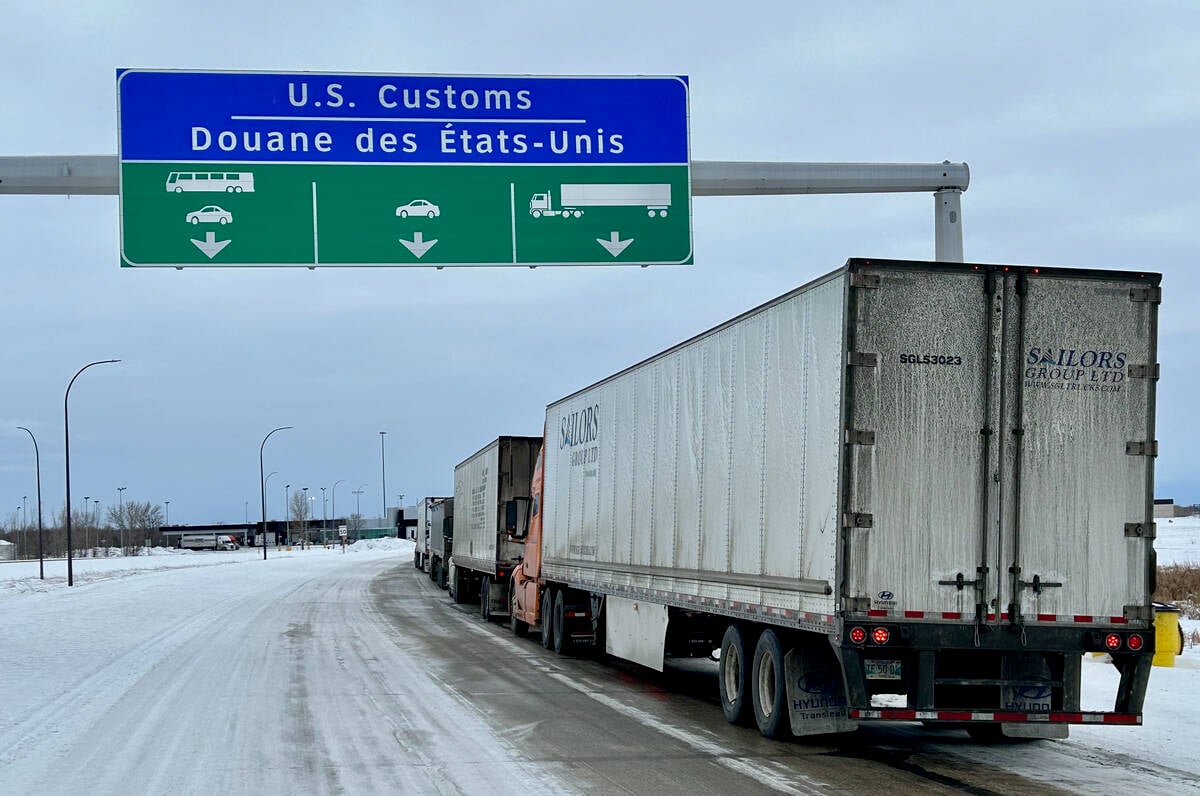
U.S. bill could keep out Canadian truckers
The Protecting America’s Roads Act, which was tabled in the U.S. House of Representatives at the beginning of October, would “rid the country of illegal immigrant commercial truck drivers and ineligible foreign nationals.”
“Groups all along the way have the same concerns as me,” said Davison. “Will there be enough? Will it be good quality? Is it being managed well?”
Davison said she has been following progress of the South Saskatchewan river basin regional plan and wants to make sure water issues are given their due when the plan is finalized.
“It needs to be right,” she said.
She is planning the walk with Castle Crown Wilderness Coalition employee Carolyn Aspeslet. They are spreading word of the event and finding groups interested in hosting one of the 16 walk segments, which will be spread over 16 days.
“The two of us are sort of heading it, and we will be the two in charge of the whole thing, but what we’re hoping it will be is basically 16 different segments with different people with different initiatives,” said Davison.
The westbound route will follow Highway 1 from the border to Medicine Hat, Highway 3 from Medicine Hat to Pincher Creek and Highway 507 past Beaver Mines and into the crown wilderness area.
“Since we want to highlight many different stewardship initiatives, the walk is not the type where one person or group walks the whole route,” reads information about the event.
“Instead, the 350 km will be divided into 16 sections of between 20 and 25 km each. Then a local group will adopt each section, and will be responsible for assuring that their entire section is walked.”
On the last day of the event, July 28, Davison said everyone who participated or who is interested will be invited to walk the last leg into the headwaters of the Castle River.
A website or a link from the coalition website is in the works so individuals and groups can see the proposed route and commit to walking one of its segments.
Davison hopes some of the groups will host events or speakers in evenings after the walking is done for the day to highlight various conservation projects.
She and Aspeslet have applied for grants to defray costs, but those have not been confirmed.
However, there is no cost to any group or individual wishing to participate.
“I know there’s tons of people out there. I just don’t know where to find them.”
For more information, contact Davison at 403-628-3378 or brendadavison@yahoo.com and Aspeslet at office@ccwc.ab.ca.