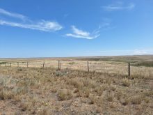

The low-pressure system that brought much needed rain to southern and central Saskatchewan and Manitoba has moved east away from Prairie cropping areas.
A separate system has moved out of the mountains into southern Alberta and southwestern Saskatchewan and has brought some rain and snow to those areas.
By Thursday afternoon much of this system will have moved south of the Canada U.S. border, as this rain accumulation map for 6 p.m. Friday to 6 p.m. Saturday illustrates. The map was issued just before noon today by the U.S. National Weather Service Weather Prediction Center.
Read Also

Using artificial intelligence in agriculture starts with the right data
Good data is critical as the agriculture sector increasingly adopts new AI technology to drive efficiency, sustainability and trust across all levels of the value chain.

The following collection of maps shows the precipitation forecast for Friday May 13 to 6 p.m. Friday May 20. The maps show no significant rain event for Prairie cropping regions for the next week.

This 24-hour rain accumulation map from Environment Canada shows the areas that were given a drink over the past day.


The following maps from the U.S. Environmental Modeling Center at NCEP show the precipitation prediction for May 19 to May 25. There is an above average chance of precipitation for southern Saskatchewan as well as southern and western Alberta.

In the week of May 26 to June 1 there are no major weather patterns predicted, as the following map illustrates.

The precipitation forecast map for June 2 to June 8 does show a weather system could start to move into Prairie cropping areas from northern Alberta.

The following collection of maps from the U.S. Environmental Modeling Center at NCEP show the mean temperature forecast, starting in the week of May 12 to May 18, and ending in the week of June 2 to June 8.
The May 12 to May 18 map indicates the temperature will be 3 to 6 degrees below average. From May 19 to May 25 a wide difference in temperature is likely between northern and southern regions of the Prairie provinces.
Then for both the May 26 to June 1 map, and the June 2 to June 8 map it is likely the temperature will be higher than average for much of the Prairie growing areas.