Rare is the prairie conversation that doesn’t start with talk about the weather.
Agriculture Canada would like to hear more of that talk.
The Agroclimate Impact Reporter program has been around for 15 years as part of the drought watch program established by the former Prairie Farm Rehabilitation Administration.
About 350 volunteers report on the Prairies and British Columbia’s Peace River region, but the program has now gone national and more participants are welcome, particularly as more extreme weather events occur, said Trevor Hadwen, an agroclimate specialist in Regina.
Read Also
Herbicide resistance sprouts in Manitoba’s wild oats
Farmers across Manitoba this fall are gearing up for the latest salvo in what, for many, has become a longtime battle to beat out wild oats.
He said reporting how much rain is received tells analysts only part of the story.
“What we’re really looking for is how that dry weather is actually impacting a farmer,” he said.
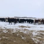
“What is his story or what is her story on the farm? Are they needing to purchase extra feed? Are they having increased cattle mortality be-cause of increased disease? What are the issues that are occurring?”
The program produces maps to help producers and scientists under-stand what’s happening to agroclimate conditions locally and regionally.
The information could help identify risks, such as a looming drought.
“We really want to start documenting how the weather impacts agriculture,” Hadwen said.
“We know it has a significant role, but when we start to put together some of our policies to try to provide assistance programs to producers, the question always come back to us, ‘we’ve received 40 percent of normal precipitation, so what?’ ”
Hadwen said there are three ways to participate:
- Send in a report online, by phone or by fax.
- Sign up as a subscriber to receive a monthly email containing five to 10 questions. This option allows people to remain anonymous but does require a land location.
- Register as a member. Hadwen said these volunteers will receive the same survey, but officials will be able to contact them to follow up on particular issues.
Monthly maps are produced to show particular impacts. For example, one map shows land that was seeded and subsequently lost to flooding.
Hadwen said the reporter network has been stable during the course of the program, and the addition of more reporters will help everyone better understand the effects of climate variability and severe weather.
Improvements to the website are expected to be made within the next week or so.
For more information, visit www.agr.gc.ca/air.

