MORRIS, Man. – There was more excitement than usual along the morning run for Pepper and Shadow.
But there was also a lot less traffic.
“Usually it’s pretty busy here,” said Lloyd Penner, who halted his Beagle Pepper, his Husky-Collie cross Shadow and his quad for a few minutes so that he could look out over the Morris River, whose banks had disappeared under waters flowing in from the flooding Red River a few hundred metres away.
The water had reached the edge of the ring dike that keeps the town safe from the frequent floodings of the rivers.
Read Also

Phosphate prices to remain high
Phosphate prices are expected to remain elevated, according to Mosaic’s president.
An hour earlier the Manitoba government had closed Highway 75, the province’s main link to the United States, because water had begun to seep across the bridge leading into Morris. Wet truck tires threatened to destroy the clay and limestone gravel ramp that was filling in the gap between the east and west sides of the ring dike.
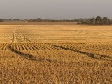
All along the Red River Valley farmers and rural dwellers are fighting against the overflow. The peak of the flood from North Dakota is expected to hit Manitoba’s Red River Valley during the Easter weekend.
This flood is expected to be similar to the one in 1996 that covered thousands of acres, but nowhere near as devastating as the 1997 flood, which drowned huge amounts of farmland and destroyed many farm buildings. It also flooded or cut off a number of villages and towns. Since 1997, more than $150 million has been spent on flood mitigation projects.
At the closed entrance to Morris, dozens of local people wandered down to look at the bulging river and to take photos.
“This is a good flood,” said Rural Municipality of Morris reeve Herm Martens, standing on the dike and seeming as relaxed as any farmer with his land under water could be.
“In 1979, it was rainy all the time (during the flood) and people were depressed. They were down on everyone and everything. But the emotions of the people are a lot better when you have sunshine like today rather than dreary rain.”
Much of Martens’ land is under water, but his house is high and dry, and he is used to Aprils in which it is easier to float than drive.
“We don’t like it, but we live in the valley, we know we’re going to get this, we know we’re going to get inundated,” said Martens.
“We’ve learned to live with it.”
Traffic to the U.S., including the thousands of weanling pigs that travel south to Iowa every week, was being redirected as of April 10 to Highway 3, which leads through Carman.
Penner, who drives a school bus, said most of his bus route through the countryside south of Morris that morning had been clear of water.
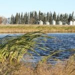
Along the Red River most farmhouses are either built atop man-made hills or are surrounded by tall dikes. There was little sign of panic along the valley.
To 91-year-old Ed Manikel, a retired farmer who had walked to the top of the ramp to look at the floodwaters lapping at the entrance to Morris, this flood didn’t seem too frightening. His reference point for fear wasn’t the 1997 flood, but the 1950 flood.
That flood forced his family to move cattle to higher land, but every day he would have to row back out to the farm, more than five kilometres, to feed the chickens.
“That was hard work,” he said.
“I don’t think people would do that these days.”