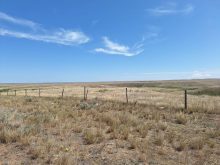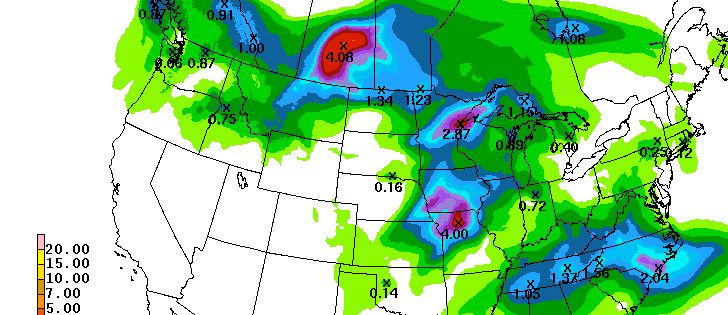
UPDATED – Rainfall map updated July 11, 2016 – 0845 CST – As we have reported for several days, heavy rain is expected in southern Saskatchewan on Monday and Tuesday.
The early indication was that much of the rain would fall in the border region between Alberta and Saskatchewan but the most recent forecasts now have the largest accumulations happening in south central Saskatchewan.
The accompanying map shows the U.S. Weather Service Weather Prediction Center’s forecast map, issued mid-day Sunday, for accumulated totals for Sunday night, Monday and Tuesday.
Read Also

Research looks to control flea beetles with RNAi
A Vancouver agri-tech company wants to give canola growers another weapon in the never-ending battle against flea beetles.
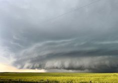
RELATED: Heavy rain to cause headaches for farmers
Environment Canada issued the following advisory late Sunday morning.
“A slow moving low pressure system over southern Saskatchewan is expected to intensify and give an area of significant rain to much of the southern portion of the province by Tuesday.
“Strong, potentially severe thunderstorms ahead of the system will develop tonight and are expected to give generally 20 to 30 mm of rain with much higher amounts in thunderstorms.
“As the low pressure system intensifies overnight, heavy rains will continue and could give close to another 40 to 50 mm of rain by Tuesday morning.
“Although there is some uncertainty in the exact area and intensity of the heaviest rains, 48 hour total rainfall amounts, in some areas, could exceed 100 mm with this event.
“Please continue to monitor alerts and forecasts issued by Environment Canada.
“To report severe weather, send an email to storm@ec.gc.ca or tweet reports to #SKStorm.