UPDATED – 15:30 CST Thursday July 7 – The forecast model map issued Thursday afternoon from the U.S. Weather Service Climate Prediction Center shows the rain events for the coming weekend and early next week could produce the largest accumulation along the Alberta-Saskatchewan border.
Although almost all the Prairies are still expected to get some rain, the updated forecast shows lighter accumulations in eastern Saskatchewan and Manitoba than the Wednesday forecast. Also the accumulation for Iowa is lighter than the Wednesday forecast.
This is the five-day accumulation forecast issued Thursday afternoon, covering the period roughly from Friday to the end of Tuesday.

The following was the seven-day accumulation forecast issued Wednesday afternoon.

The following map was the forecast that was issued Wednesday morning.

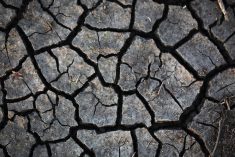
The following map from Agriculture Canada shows percent of normal precipitation over the past 30 days to July 4. Most of the Prairies have had average to above average moisture in the period.
Southern Alberta, the foothills and areas around Red Deere have had less than average rain.