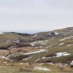
Cooler weather forecast ahead of much warmer temperatures for the weekend of May 4-5 could ease the flood risk in some parts of Saskatchewan, provincial officials said April 29.
Water Security Agency spokesperson Patrick Boyle said warmer temperatures late last week produced quick increases in outflow on tributaries and resulted in localized flooding.
“In those areas where the runoff has started, (the cold weather) will allow flows to pass somewhat before any further snow melt happens,” he said.
“So that’s going to help alleviate the peaks.”
Read Also

Powdery mildew can be combine fire risk
Dust from powdery mildew can cause fires in combines.
The situation in Manitoba is similar after cooler weather there also mitigated flood risks in the Red River Valley. Forecasters said flooding in the valley will likely be comparable to 2006, which is below levels seen in 2011 and well below 1997, Manitoba’s flood of the century.
Back in Saskatchewan, flooding at Maidstone in northwestern Saskatchewan resulted in a state of emergency because of problems with the sewer system. Lashburn and Borden also saw flooding.
The rural municipality of Great Bend issued evacuation notices to farms south of Highway 16 near Radisson April 28-29 as water from tributaries of the North Saskatchewan River rose. Administrator Barry Hvidston said Borden and farms north of the highway were all on alert for possible evacuation. The water had washed out five roads and was stopped just outside Borden by the train tracks for the time being.
The hamlet of Hoey near Prince Albert was issued a precautionary drinking water advisory after flood water contaminated its treated water reservoir.
Water caused problems on both road and rail during the weekend of April 27-28.
Two locomotives and a car on a Via train headed from Winnipeg to Churchill came off the tracks April 28 near Togo, Sask., along the Manitoba border. There was also a small engine fire.
None of the seven passengers was injured. They were taken by vehicle to Duck Mountain Provincial Park.
Thirty-five sections of provincial highway were affected by water and either closed for a time or required flagpersons to direct traffic.
Highways ministry spokesperson Doug Wakabayashi said two culverts have been damaged: one on Highway 2 north of Wakaw and one on Highway 6, south of the junction with Highway 39 in the Milestone area.
The westbound lane of the Trans-Canada Highway near Sintaluta was open but water was flowing over it and drivers were required to reduce speed.
Emergency management officials said they continue to monitor areas where flooding is expected, particularly in the Regina-Moose Jaw-Weyburn-Indian Head region.
Duane McKay, executive director of emergency management and fire safety with the provincial government, said Moose Jaw appears well prepared for the possibility of flooding.
Boyle said there is still extensive snow pack on the east side of the Moose Jaw River. However, Thunder Creek has already melted, which means two peaks won’t arrive at once.
Outflow from the Avonlea Reservoir peaked April 28 and is declining. Flow on the river at Rouleau increased from 20 cubic metres per second to 91 m3/s April 29.
Water from the Moose Jaw River is backing up over the dam at Buffalo Pound Lake, and flows on the Qu’Appelle River are increasing as that water arrives.
Flow on Wascana Creek, which also contributes to the Qu’Appelle system, was just beginning April 29. Peaks in Regina are expected to top 2011.
The peak on the Battle River system at the Battlefords was expected April 30 at rates double 2011 and higher than 1985. The water will be 1.2 to 1.5 metres higher than 2011.
Most other systems were seeing increased flow but many were expected to decline without causing serious problems.
The gates on the Rafferty Reservoir on the Souris River system, which saw so much devastation in 2011, are open and outflow is 50 m3/s, less than the forecasted range of 60 to 80 m3/s.
Check www.producer.com for daily runoff and flood updates.