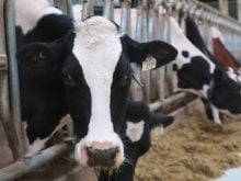
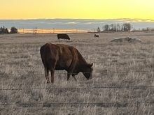
Farmers could benefit from new research into an atmospheric phenomenon that could help predict the weather months in advance.
Mark Baldwin of Northwest Research Associates in Bellevue, Washington, has discovered a previously overlooked relationship between two levels of atmosphere and their effect on weather.
“It’s another tool that might help industries … such as agriculture,” Baldwin said.
“Farmers may not change their individual cropping plans, but it might help decide about buying (crop) insurance or in making longer term marketing plans if they have a better idea of potential heating degree days a month or two ahead.”
Read Also

The Organization for Economic Co-operation and Development lauds Canada’s low farm subsidies, criticizes supply management
The Organization for Economic Co-operation and Development lauded Canada’s low farm subsidies, criticized supply management in its global survey of farm support programs.
Only a small portion of weather prediction is now based on two layers of the atmosphere called the troposphere and stratosphere.
The troposphere is the highly variable layer where 80 percent of the planet’s total air mass is located. It is where clouds appear and disappear and where temperatures rise and fall.
The stratosphere is the more stable layer above the troposphere. It is a dry band of gas and dust with a fairly constant temperature range and thickness. It is located 16 to 20 kilometres above the earth’s surface, and is thinner at the poles.
It is at the North Pole where scientists had missed a powerful relationship to terrestrial weather.
The stratosphere is constantly pushed up by effects from the earth, causing waves in that layer. When the stratosphere bounces back from the upward force, it pushes the troposphere lower at the pole, increasing the pressure in that region.
Resulting high-pressure systems in the north cause a ripple effect from the Arctic Circle, which drives cold weather to the south and disrupts the warmer westerly flows from the Pacific Ocean that usually warm northern North America.
“What goes up must come down,” Baldwin said.
“When the stratosphere comes back down, it creates high pressure systems that cause longer-term weather effects … in a swath that cuts from the Pacific Mountains to the Great Lakes.”
He said the effects are also felt in Russia and northern Europe.
Knowing about the phenomenon will not change the weather, but it may make weather events more predictable.
The stratosphere responds more predictably than the troposphere.
The phenomenon occurs only when the stratosphere is at its weakest, from November to March. When it happens, the wave disrupts the polar vortex, a clockwise circulation in the stratosphere that winds around the North Pole. The vortex can be monitored relatively simply using weather balloons and satellites.
“The effects can be felt over a longer term (up to two months),” Baldwin said.
“You could expect to predict the effects into May or early June.”
He said cooler weather across the Northern Hemisphere becomes twice as likely for two months after the polar vortex weakens.
The discovery isn’t a sole indicator that colder temperatures are destined to follow, but it gives meteorologists an “edge” when it comes to making longer-term predictions.
The high-pressure systems can make the troposphere unstable, which can result in unusually powerful storms or “snow in Dallas.”
So far the discovery is only being used as a basis for further research and to improve weather pattern computer modeling at the European Centre for Medium Range Weather in the United Kingdom.
Andre Methot of Environment Canada said the department has its own medium-range weather program.
“Our forecast systems are improving constantly as we transfer technology from our research side to operations (forecasting). If this works, it is the kind of data that could quickly move from research to operations.”
Methot said that because Environment Canada researchers work with their U.K. counterparts, the technology will likely be used in future Canadian forecasts if it proves effective.