When the glaciers retreated 16,000 years ago, they left a mess in some areas and deep piles of excellent soil in others.
In many locations across the prairie provinces, the fine line between gravel and good soil is only a few hundred metres wide.
The footsteps and ox cart tracks of the first European settlers moving west and the sites they chose as home closely followed the soil patterns left by those glaciers.
The first farmers to arrive in each new area got the best ground.
Read Also

New Alberta funding for program hopes to further unlock agritourism industry in province
Alberta Farm Fresh Producers Association is launching a new initiative thanks to $300,000 of provincial funding to bolster Alberta’s smaller scale family farms and agritourism sector.
Beyond that, it was progressively slimmer pickings as the mid-1800s rolled along into the 1900s. It was usually tough luck for the late comers in any region.
In the earliest days of settlement, before farming was even contemplated, the driving factors were water and wood. The trapping and trading economy required water for transportation and wood for housing and heat.
The environment provided food, so soil quality didn’t matter. Lakes and rivers were the highways of the day, and early settlements were strategically located along those waterways.
But as European influence increased, horses began to play a larger role. Now, the list of essential ingredients expanded to include hay. This transition was significant because soil was a consideration for the first time.
These early arrivals, including the Métis with their harnessed wild prairie ponies and early Scottish settlers, had fate on their side. They had the good fortune of settling in the unbroken tall grass prairie of the Red River Valley.
Today, it’s called the black soil zone and is some of the richest farmland on Earth. Hay for horses was free for the cutting.
By the mid-1800s, agricultural settlers gradually migrated west from The Forks, or Winnipeg, as it’s called today.
Rivers and lakes that had been the main transportation routes in the fur trading days now became obstacles. Moving a wagon or ox cart through undrained marshlands and low-lying areas ranged from difficult to impossible.
The high quality soil beneath some of those vast wetlands didn’t matter at the time. Agricultural interests would return later to drain the wetlands and turn those areas into productive cropland.
But in the mid1800s, travelling west on dry land was the chief consideration.
Annual spring floods and occasional summer floods forced settlers to travel along the gravel ridges, says Ted Poyser, a soil scientist who was instrumental in creating the firstManitoba Reconnaissance Soil Survey,which was published in 1953.
“Those early trails heading mainly northwest followed the soil conditions,” says Poyser.
“Once they got out of the Red River Valley, they followed that ridge that starts north of Portage la Prairie and runs up through Neepawa, Shoal Lake and up toward Yorkton.
“These trails followed the historic Indian upland paths, simply because they allowed people to cover more miles in a day.”
The basic pattern ran from The Forks up to Fort Edmonton, a fact that would later be a major factor in prairie settlement because of the high quality soil that route happened to follow.
“There’s a lot of good farmland along that route, which explains why all those early towns sprung up where they did. The newcomers settled on the best land and stayed out of the marshes and forests.”
That travel pattern more or less followed what is now called the grey and dark grey soil zones and the top of the black soil zone. There were seemingly limitless potholes and sloughs, but the high land between these water traps looked like it could grow good wheat.
The need for carts and wagons to travel on high ground disappeared quickly in the late 1870s as rail transportation pushed west.
Once the railways bridged rivers and crossed rough terrain, settlers were able to make the journey to their new homes quickly and with more tools and supplies than they carried by cart.
As the railroad penetrated new areas, it gave settlers access to land that was far removed from their original upland trails across the northern Prairies.
Agricultural settlement of the Prairies was a top priority for the federal government and business leaders, who envisioned a vast prairie wheat field, with farmers buying merchandise from Ontario industry and selling grain back to Ontario.
As that grand plan gradually became reality, the colonial nature of the relationship between east and west provoked the ire of prairie farmers, leaving a legacy of suspicion and distrust that persists today. That ire was manifested in the formation of farmer grain co-ops in the early 20th century.
Nonetheless, the federal government was in charge of western settlement. To help facilitate its plan, it initiated the Dominion Land Survey in 1871. Covering 309,000 sq. miles, it is the world’s largest survey grid laid down in a single integrated system.
An imperfect plan
Although the system and its terminology are deeply ingrained into prairie culture, there was criticism from the beginning that the system didn’t suit Western Canada.
For one thing, it did not recognize or incorporate the differences in geography.
“The government came along and said, ‘well, this haphazard settlement isn’t what we had in mind. It’s not organized,’” says Poyser.
“So they imposed the quadrilateral system of survey to cut it all up into 640 acre squares.
“That’s maybe fine in some areas, but in most areas the grid system doesn’t match the topography or soil conditions in any way.”
Unfortunately for farmers, it wouldn’t be until 1963 that the federal government returned to the Prairies to conduct the Canada Land Inventory, identifying seven main soil classes and 13 sub-classes. Prior to 1963, a shovel provided the best soil information for a farmer looking at new ground.
In 1872, the federal government passed the Dominion Lands Act, known today as the Homestead Act. It entitled a person to buy a quarter section for $10 plus an additional quarter for $320.
The Canada Land Survey, the Homestead Act and the railways formed the tripod upon which the massive settlement program was based.
Much of southwestern Manitoba was settled in the short span of 1881 and 1882, mainly by immigrants from Ontario and Britain. Nearly 60,000 settlers arrived in that short period, facilitated by the new rail connections.
From a botanist’s point of view, the area surrounding Brandon would have fallen into the mixed grass class. For a farmer with a shovel, however, it was almost as good as the black soil supporting the tall grass prairie in the Red River Valley.
By the late 1890s and early 1900s, land with the best agricultural potential had been claimed. Ukrainian and later Polish immigrants arrived in Western Canada and were directed to the Parkland region.
An abundance of wooded land to provide building materials and heat was small consolation for being pushed onto the northern fringes of the grey soil zone.
Cpt. John Palliser, working on behalf of Britain from 1857-60, travelled the Canadian prairie with the intent of assessing the agricultural potential for future British immigrants.
Palliser happened to hit a number of dry years, prompting him to report that the triangle he named after himself held no potential for agriculture or permanent human habitation. It encompassed southwestern Manitoba, southern Saskatchewan and southeastern Alberta.
In 1858, Henry Hind travelled the prairie and made the same evaluation of the triangle. However, both surveyors agreed there was a belt of fertile land that ran northwest from Winnipeg to Edmonton.
This belt was the northern triangle boundary and is basically the same ground Poyser refers to as the upland trail that early settlers followed so they could stay out of the prairie marshlands.
Palliser and Hind must have been using their shovels because this northern belt is known today as the black and dark grey soil zones. They recognized that it had excellent potential.
Reports of this fertile soil belt fanned the flames of optimism and set the stage for major waves of immigrants from the United Kingdom.
Mapping the Palliser Triangle
Fuel was added to those flames in the early 1870s when Canadian botanist John Macoun proclaimed that the Palliser Triangle was in fact highly productive.
He happened to visit the area during a wet cycle, so he reported that precipitation fell mainly during the growing season, making the triangle perfect for wheat.
His reports on soil and moisture conditions prompted the Canadian Pacific Railway to push its line through the southern Prairies rather than take the northwest route it had originally planned.
The rail line and Macoun’s optimism were major factors in the settlement of the vast tracts of land in Saskatchewan and Alberta that had been ignored by earlier settlers who travelled by cart.
Macoun’s soil reports changed the shape of prairie agricultural settlement. Had he agreed with Palliser and Hind, it might have been another 50 years before settlers discovered the productivity of the Palliser Triangle.
The triangle that Palliser thought was nothing more than a northern extension of the American desert turned out to have some of the best cropland in Canada.
Botanists classify the Palliser Triangle as mixed grass prairie through southwestern Manitoba and most of southern Saskatchewan.
In southwestern Saskatchewan and southeastern Alberta, botanists classified the native fauna as short grass prairie.
Those are the above-ground features agricultural settlers would have seen. Below the surface, however, it’s a different story.
The southern core of the triangle falls into what is now called the brown soil zone, extending north to Scott, Sask.
That basic triangular shape has a periphery north of Scott, which is called the dark brown soil zone.
Above that, the northern shell of the triangle features the black and dark grey soil zones that first attracted farm settlers.
Macoun’s opinion that the entire triangle was capable of supporting crops differed from the opinion of the Canadian government.
Based on the information from Palliser and Hind, the government had deemed the triangle to be suitable only for large scale ranching and put policies in place to support the premise.
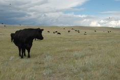
Large scale ranching remained the primary activity until the severe winter of 1906-07, when approximately 70 percent of the cattle in southwestern Saskatchewan died. Farming began to replace ranching in the triangle after that disaster.
Welcome to Alberta
There was little agricultural settlement in Alberta until 1874-80. American ranchers had severely over-grazed most of Montana and were looking for a place to push their herds.
The obvious solution was to move north of the 49th parallel into what is now Alberta.
Running from south to north, the virgin fescue and short grass prairie spanned the brown, dark brown, black, dark grey and grey soil zones.
Each step further north revealed better soil and growing conditions. Today, some areas around Edmonton have eight inches or more of A horizon black soil
But in the 1870s, the grass growing on the surface was all that mattered. The new ground provided ranchers with excellent grazing compared to Montana. The Chinook winds allowed year-round grazing.
But ranching remained the main activity until 1883, when the CPR reached Calgary and the first farm-oriented settlers arrived, staying mainly in southern Alberta.
However, farming in Alberta was slow to take off.
The railway and federal government launched major campaigns to attract Ontario farmers and off-shore immigrants to the western Prairies. The railways financed their main line and branch lines by selling parcels of land granted them by the federal government.
The more land they sold, the further they could push the steel rail into new cropping country. By the turn of the century, all good cropland had been claimed, with the exception of the Peace River Valley, considered to be the last great frontier for farmers.
The Peace was cut off from the rest of Alberta by a 300 kilometre wide strip of muskeg and forest. The area wasn’t investigated until the federal government sent surveyors and geologists to determine if this might be a suitable rail route to the Pacific coast.
Reports came back that the isolated region had excellent soil. After 1900, the federal government opened the 3.5 million acre Peace Country to settlement. By 1911 nearly all available land had been claimed.
Farmers came from across North America and most European countries to get their foothold in this last farming frontier.
Today, those endless miles of bush and muskeg have been cleared and drained to turn Peace Country into a highly developed agricultural region, with Grand Prairie as a major farming centre.
“The wetlands and marshes that got in our way 150 years ago have all been pretty well drained by now,” Poyser says.
“The Canadian Prairies have one of the most altered ecosystems on the planet. Brazil is lagging far behind us when it comes to obliterating nature’s ecosystems.”


